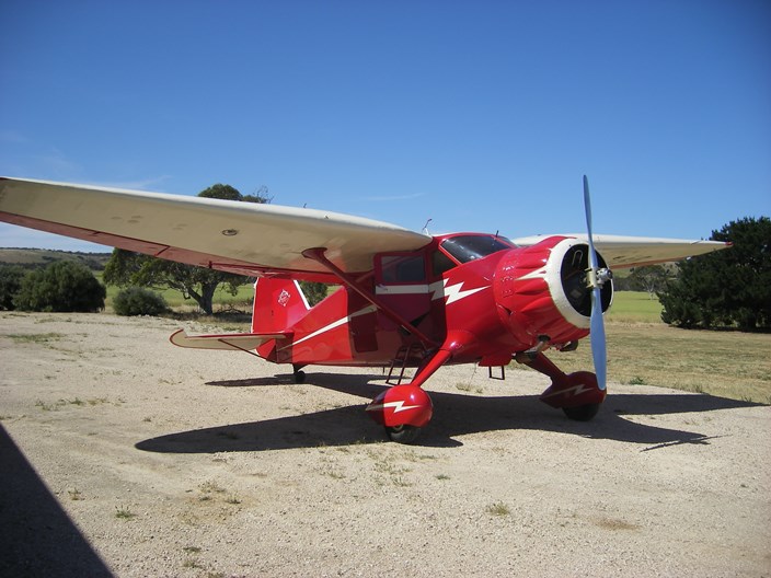
I had been itching to do another longish flight in my Sonex when Tony Richardson suggested the Jamestown Air Show. The logistics were worked out. I would fly across to Callington, near Adelaide on the Saturday and stay with Tony and Lynne Saturday night. He even found me hangar space. We would start out early Sunday morning to cover the 120 nautical miles to Jamestown before the 10AM cut-off time. Lynn Jarvis was keen to have a ride in the 3300 powered Sonex (something he would regret later) so I would give him a ride up and Tony would take him home. It was all settled.
My planned route was via Horsham, Naracoorte and Goolwa to Callington, with fuel stops at Naracoorte and Goolwa, which is only a short hop from Callington. I would be able to top up at Jamestown for the home trip via Mildura.
The only place directly between Melbourne and Adelaide where fuel is available is Horsham, but I wanted to go along the SA coast so headed for Naracoorte via Horsham, which took me around the northern end of the Grampians. A 30 knot headwind was forecast so I decided not to risk strong turbulence over the mountains. Fortunately, the wind was a bit lighter and I was able to maintain a ground speed of 105 to 110 knots.
There are probably many memorable things about Horsham, but the following is what I remember.
There was a young fellow from Horsham
Who took out his balls to worshem
His mother said “Jack, if you don’t put them back
I’ll jump on them both and squorshem”.
To the south of Horsham is/are The Grampians, rather unimaginatively named after The Grampians in Scotland. Gariwerd, the aboriginal name is probably better, but whatever the name, it’s a beautiful little mountain range made of sandstone that has tilted up at about 30º so that the western side slopes up steeply and the eastern side drops off in sheer cliffs. 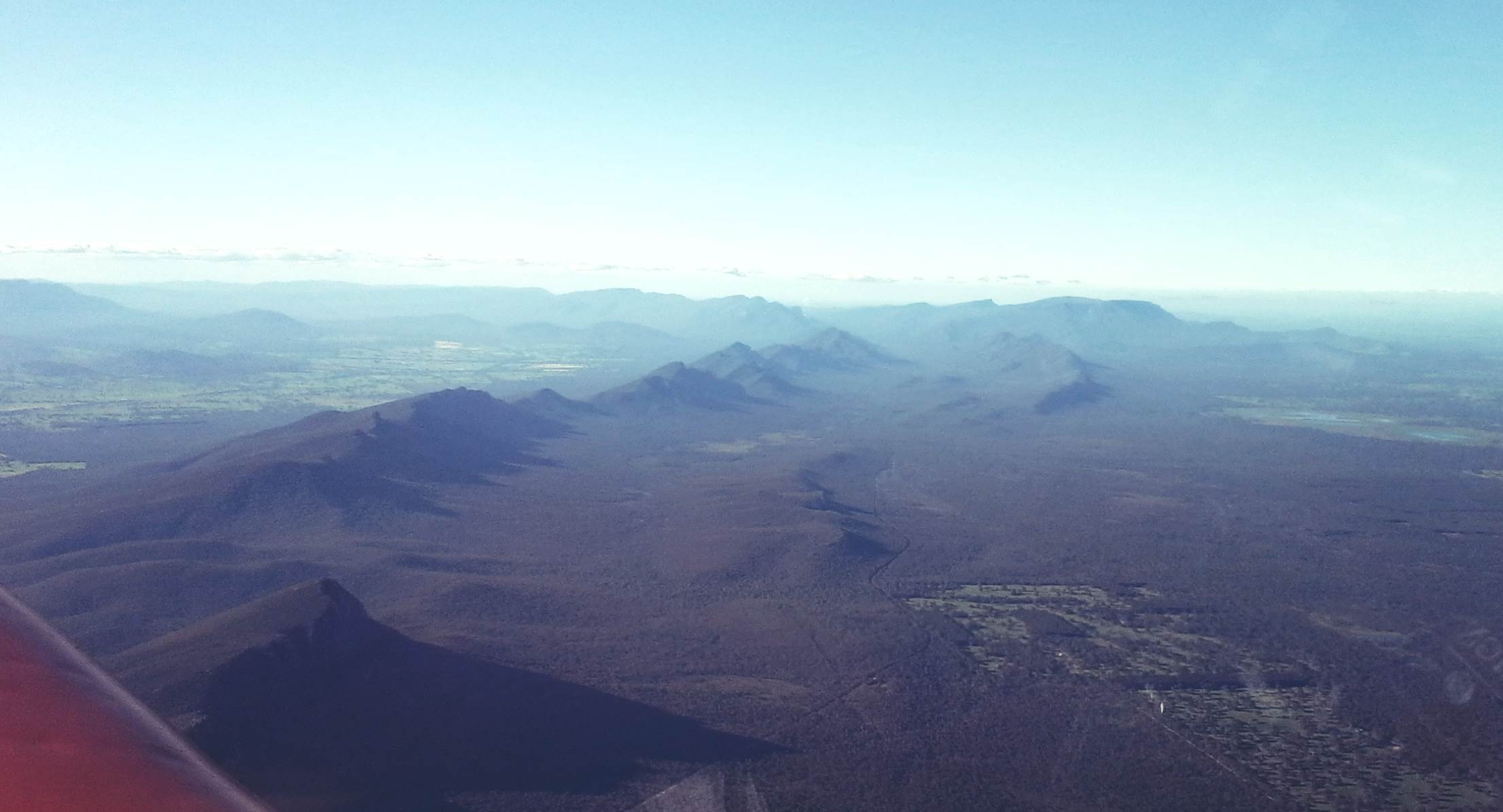 I once formed half of a stretcher team that carried a fairly solidly built woman about 2/3 of the way down these mountains after she badly sprained her ankle. I could just about touch the ground without bending over after that and it took my body about a week to recover.
Mount Arapiles, about 18 nm from Horsham, also slopes to the west with sheer cliffs on the east and is much loved by rock climbers. I took about 5 photographs and they are all rubbish. Also in the area are large numbers of small salt lakes, something I was to see much more of. You will pretty quickly reach the conclusion that lakes with actual water in them are pretty rare in Australia, and lakes with fresh water are rarer still. After about 100 minutes flying I reached Naracoorte, my first fuel stop. Big problem, the fuel pump, which relies on a Vodafone mobile connection is not communicating. I’m about to check the distance to Mount Gambier when some friendly local aero club members arrive. They reset the power in the clubhouse and bingo, the pump is back in action. I top up with 35 litres, take the time for a chat and then head off on 306 º which will take me along the South Australian coast and the Coorong. 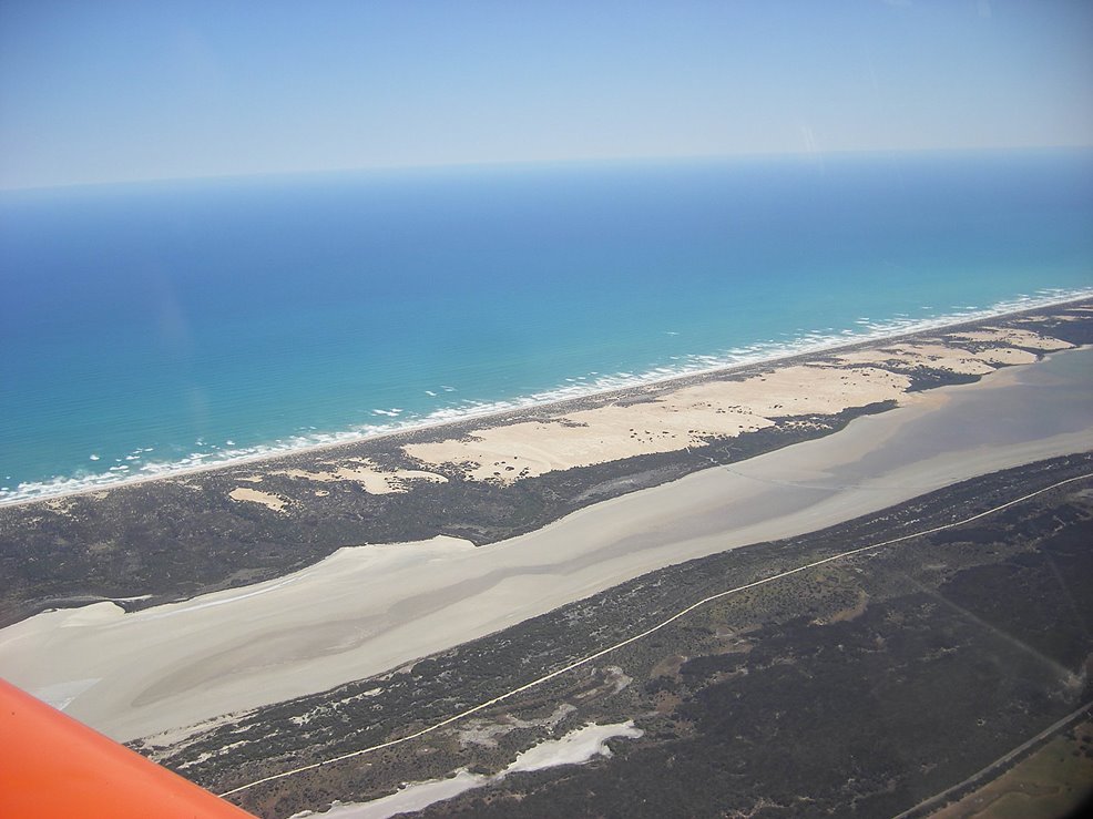 The Coorong is a vast lagoon running continuously from Lake Alexandrina and the Murray River mouth, for about 125 km along the coast. If you add up all the disconnected bits at the south eastern
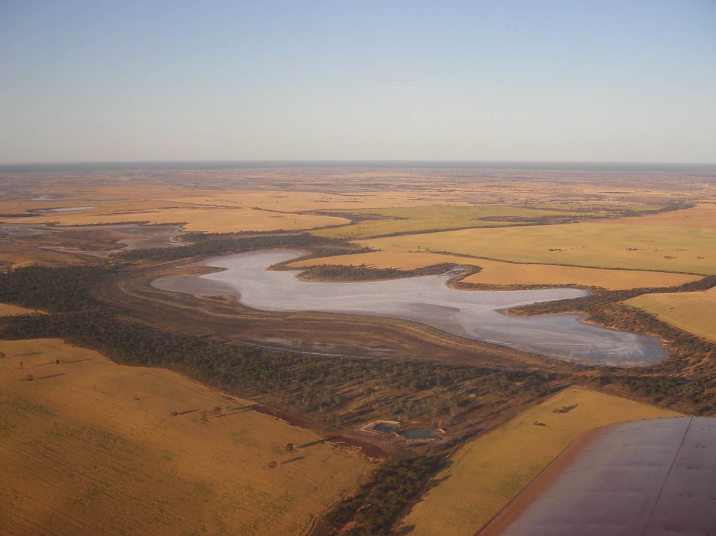
 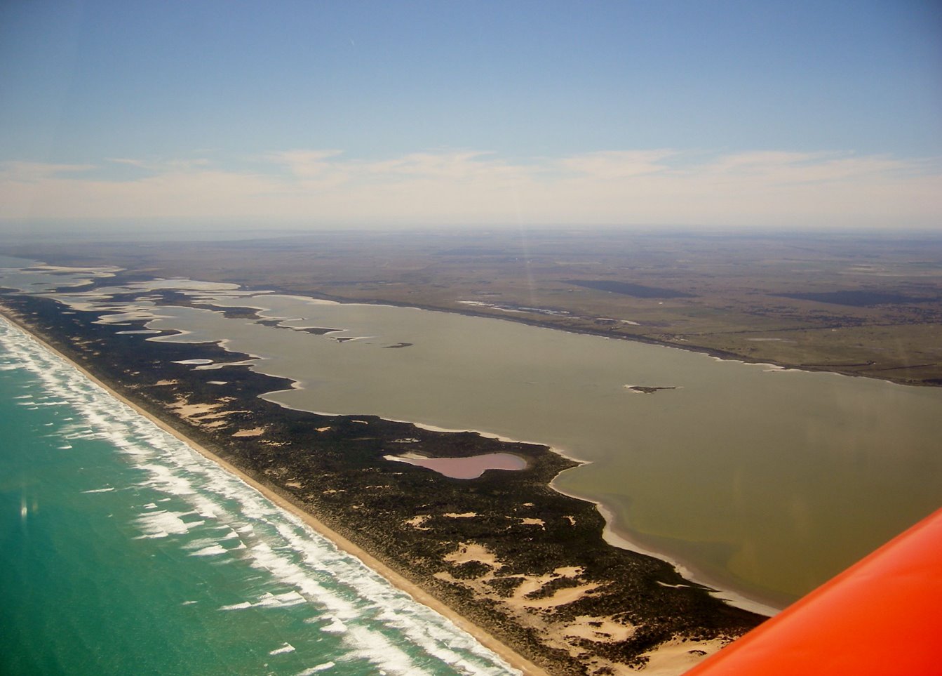 end it’s more like 160 km long. This is my second trip along here, and once again I was struck by the vivid blue of the Southern Ocean, something I couldn’t easily capture on my little Pentax snapshot camera. I had turned the corner at Naracoorte and now had a light tailwind, 132 knots groundspeed. The 130 nm went quickly and as I passed Lake Albert I started my descent.
 In between photos of Hindmarsh Island and the Murray River mouth I made my inbound call to Goolwa. It looked like runway 19 was the go, so I joined mid-downwind and did my usual impeccable (if only) landing. One of the parked aircraft was a WW2 Boomerang, ready for its flight to Jamestown for the show.
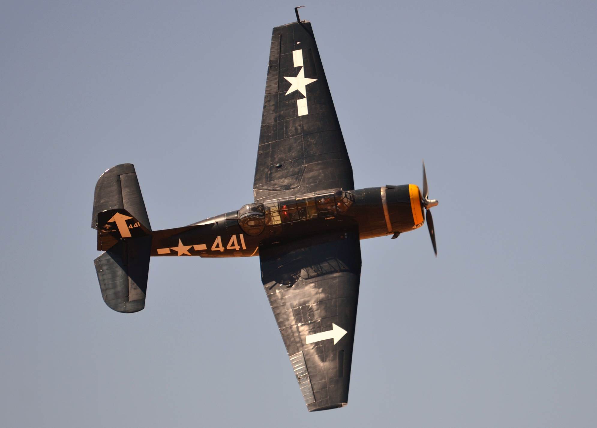
The Boomerang is an interesting aircraft. It was built at a time when most of our army was in North Africa or the Middle East or given up for lost in Singapore and most of our growing Air Force was in Europe. Our fledgling aircraft industry was only producing training aircraft, it looked like we would be invaded by the Japanese who were already bombing northern coastal towns and we had virtually no fighters. As a stop-gap, the Boomerangs were built using many parts from the Wirraway trainer, a North American N16 built under licence. I don’t think such a design could ever be a great aircraft, but they went from drawing board to first flight in 12 weeks, and 250 were produced. They were pretty well armed with four 303 machine guns and two 20mm cannons. They fly with a very distinctive whistling sound, apparently due to air passing over the gun ports. In the event, they were not needed as interceptors (phew) and they were used mainly for ground attack. Despite the small production numbers, there are two flying in Australia and I think a few in the US. Compare that with the British Hawker Typhoon of which more than 3000 were built. I think the only existing Typhoon is the (non-flying) example on display at the RAF museum at Hendon.
While I was at Goolwa, the young guy who was taking my money for fuel showed me a copy of the latest “Sport Pilot”, the RAA (Recreational Aviation Australia) magazine. Guess who’s Sonex was gracing the cover?
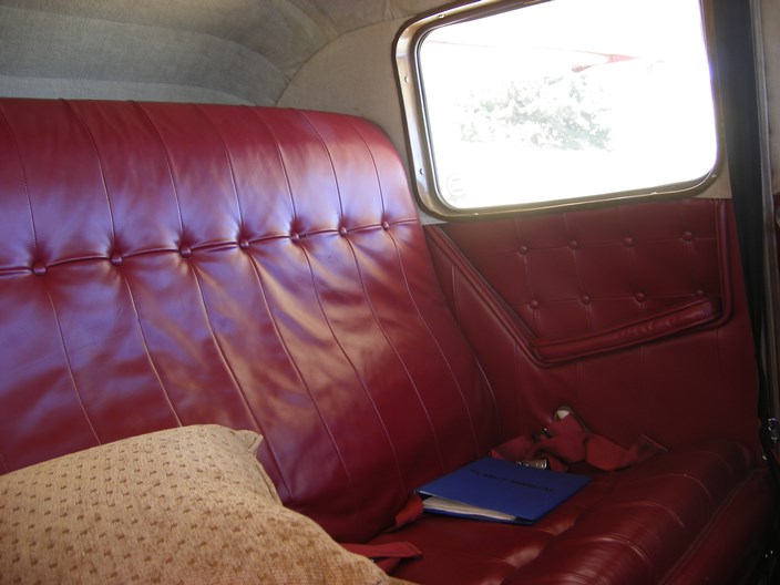
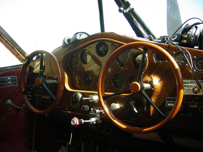
I gave Richo a call and my timing was good. He had just finished work and could meet me at Callington. From Goolwa to Callington is only a 26 nm hop so I only climbed to 1500 feet, but on a sunny afternoon there was plenty of thermal activity so I kept the speed to under 110 knots. 15 minutes of bouncing and I joined the circuit for runway 16. The ground to the east of Callington rises quite noticeably, giving the feeling that you are too low in the circuit, something that was to trouble me even more the next day at Jamestown. One of the interesting aircraft at Callington is this beautiful Stinson Reliant flown by Tim Brownridge. Check out that carved wooden instrument panel and the luxury seating for the passengers.
Tony had managed to clear a space in his hangar so we put the baby to bed and headed back to his place at Strathalbyn where I met his wife, Lynne and even a visiting daughter and grand-daughter. It was a pleasant but short visit. Thanks for the hospitality Tony and Lynne.
We made it to Callington by 7:30 next morning, where we were to meet Lynn Jarvis. Unfortunately the weather was running a bit late.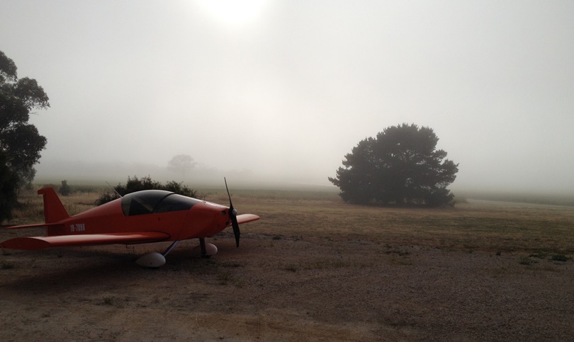 We did our daily inspections while waiting for the low cloud to disperse and then we waited some more, eventually getting away just before 9. The flight to Jamestown was uneventful, but all new territory for me. The country is mostly grain growing with several long ranges of hills running roughly north/south. Lynn took the controls for a while and we gradually left Tony behind, but were able to keep track of each other through Oz Runways. Things didn’t get exciting until we started descending for Jamestown. There was a 172 ahead, but we simply couldn’t see him, and he seemed to be determined to land against what appeared to be the circuit direction. I eventually joined downwind for runway 16 and my problems really started. Jamestown is nestled right beside one of those north/south ranges I mentioned and the wind sock was indicating a strong cross-wind. This was going to be tricky. On downwind over the range it felt like we were way too low but the altimeter said otherwise. Wafted by the strong wind I made my final turn way too late and had to drag us back in line with the runway, hardly an ideal set-up, but managed to feel like I had gained control until we got close to the ground when the turbulence caused by the wind over the hill had us going up and down like a yo-yo. I battled it incompetently until Lynn yelled “power”. Good idea, and around we went. Next time I was a bit better set up but it was still yo-yo time and around we went again. Unicom came on to suggest we land at a cross strip 10 miles north, or probably anywhere else away from them. Can I use the grass? A definite negative came back. Oh well, one more try. Well, I made it third try, but it wasn’t pretty. I taxied to our parking spot feeling chastened, somewhat humiliated but at least alive and with an unbent aeroplane. I don’t think Lynn is a religious type, but I’m sure I heard him muttering a few “Hail Marys” and when he could finally unclench his hands from the seat he got out and kissed the ground, although he pretended he was just tying a shoelace. Tony made a better landing but found himself chasing the “Follow Me” quad bike at high speed along the grass to the left of the strip without enough rudder authority to keep it all straight. That cross-wind was pretty strong. This photo may appear to show that everything is fine, but in fact I’m “going around”.
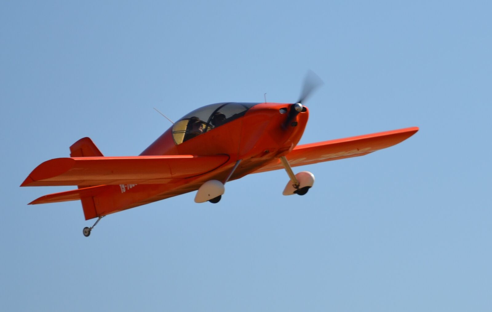
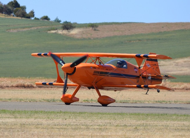
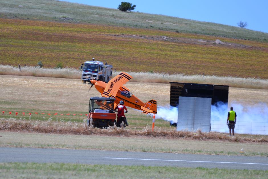
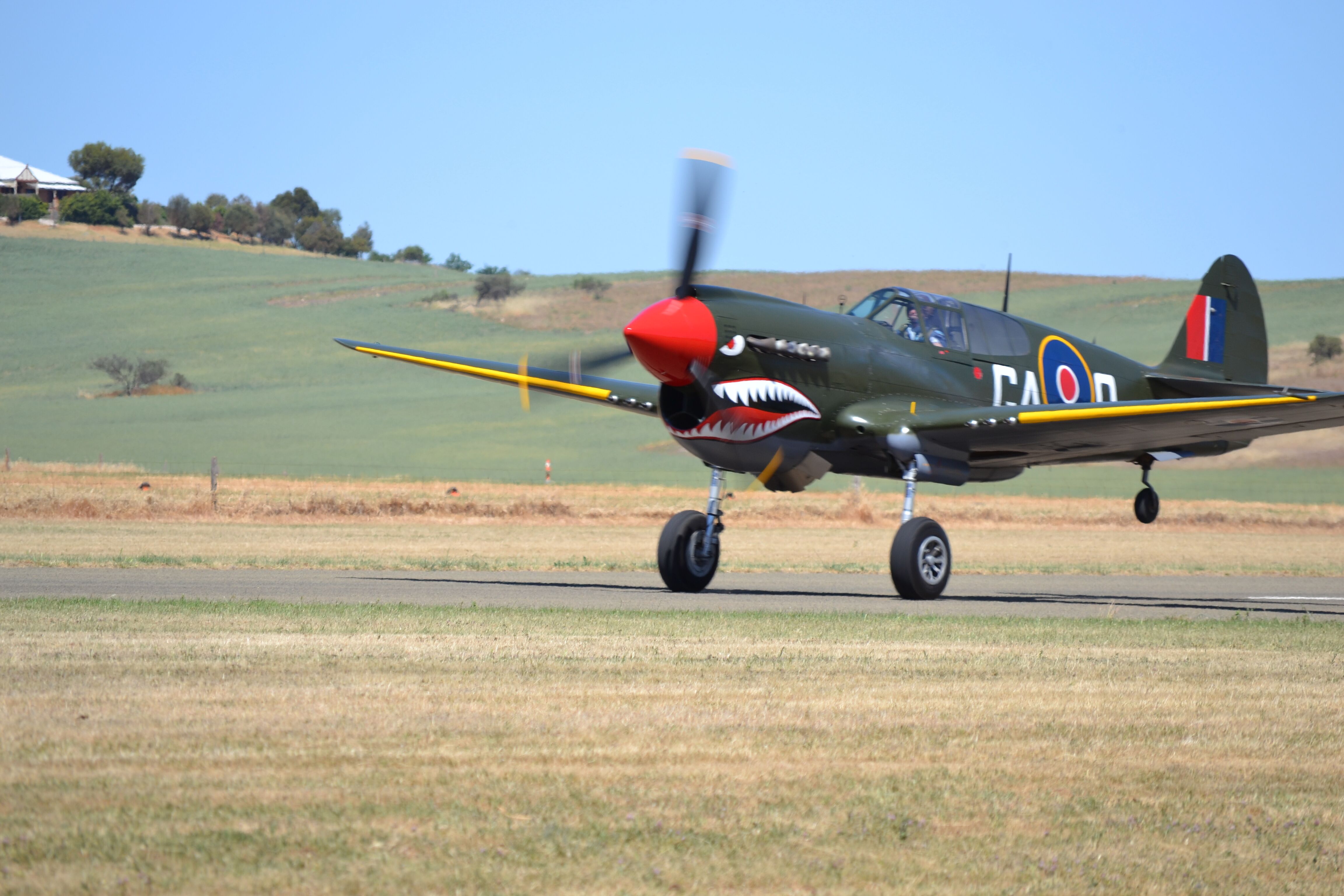
The air show was spectacular, but perhaps the oddest spectacle was Paul Bennett knife-edging his Pitts between two ramps while a motorcyclist somersaulted his bike over the top, or maybe it was the car with a jet engine. There will be better photos than I could take on their web site or the Clive Palmer photo gallery. Now where have I heard that name before? The following are thanks to Geoff Hennig.
 a
a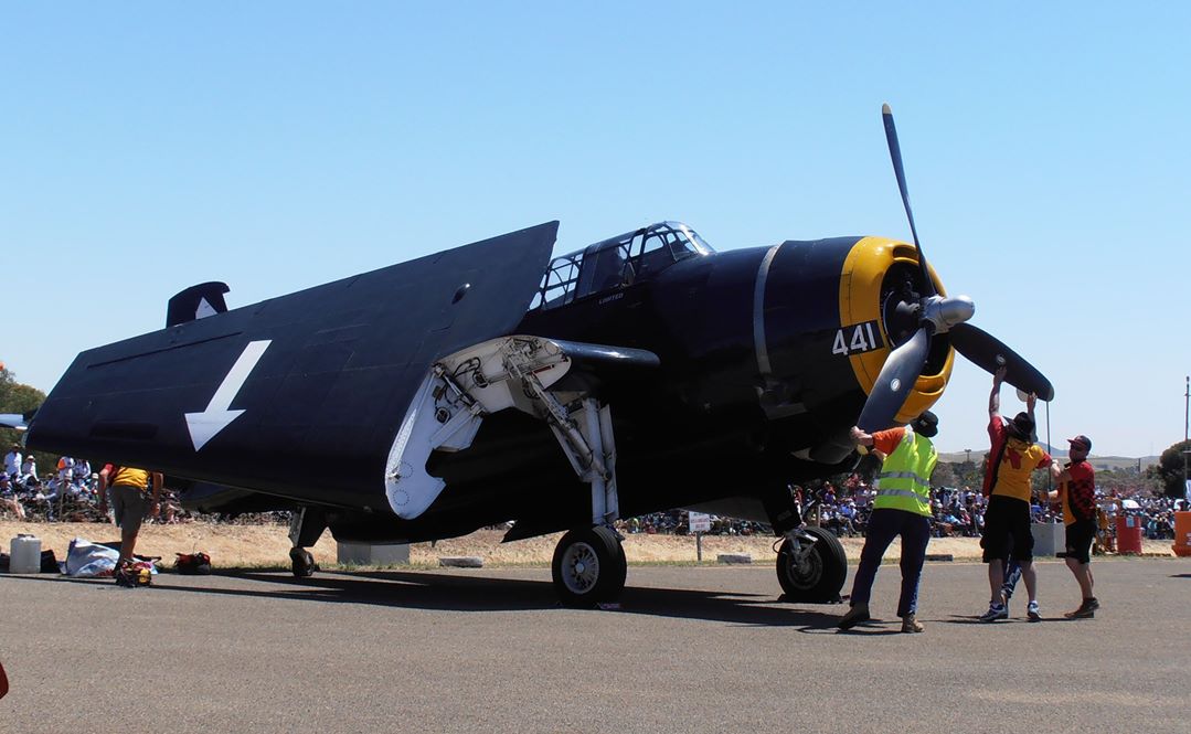
Jamestown to Mildura
At 4.00 PM I plotted my course home and joined the aircraft exodus. I could have travelled directly from Jamestown to Mildura, but that course involved about 160 nm of desert with only the odd scattered homestead. I opted to travel via Waikerie and Renmark which still involved crossing some pretty desolate territory.
I joined the stream taking off on runway 34, climbed to 1000 ft AGL and made my turn onto 121º magnetic for Waikerie. Crikey it was rough. Even after 4:30 PM there was plenty of thermal activity. Decided to try 5500 ft to see if I could get above the thermals. but no good, still rough. OK, let’s try 7500. I find climbing to high altitudes in rough weather scary. I know you are just as dead crashing from 100 feet, but from 7000 feet you have more time to think about it, and I wasn’t enjoying this much. Finally at 7300 it started to smooth out. Phew. It had been hot on the ground but the air temperature dropped at the higher altitude so I shut down my vents and blessed the joy-stick boot that Tony had made for me. It effectively stopped the freezing draft that used to come up the hole via the aileron pushrod holes and freeze my hand. I settled in for the cruise and concentrated on maintaining my course and altitude as the desert rolled by and Morgan and Renmark on the Murray River hove into view. 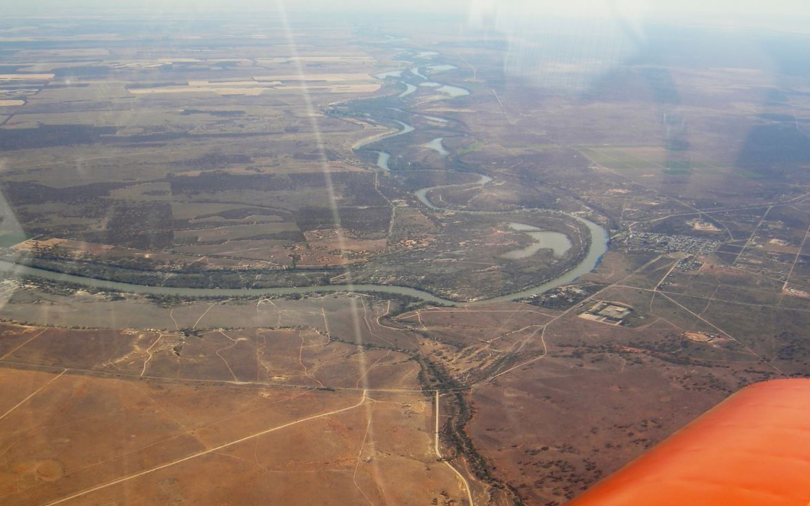
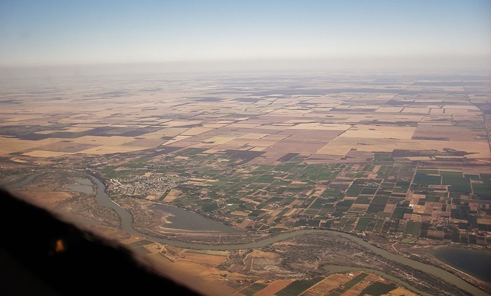
 The Murray here is virtually an oasis, a strip of green between the reddish brown of the desert and the dry straw of the wheat fields to the south. If you did the same primary school geography lessons on rivers that I did, you might remember learning that rivers have three distinct forms: the rushing mountain stream; the smooth-flowing river eroding valleys; and the slow meandering river out on the plane. Well, the Murray river must be at least 90% the slow meandering form. Mildura is only 50 metres above sea level and about 320 km from the sea but with all the twists and turns, the distance by river must be at least 600 km so the gradient is less than 1 in 12000. That’s the nature of the biggest river system in Australia.
About 20 nm out of Mildura I started my descent and switched over to 118.8. Mildura has 8 or 9 RPT services per day as well as the usual light traffic, and I wanted to keep well out of their way. All was quiet so I made a midfield-crosswind join for runway 09 and coasted in on that huge runway. 194 nm and 93 minutes for the leg. By the time I had refueled there were only 35 minutes to sundown so I tied down, googled a motel and called a taxi. The Rivercity Motel was fine except for traffic noise from the nearby intersection.
Mildura to Kyneton
I wasn’t really in any hurry to leave, but the traffic woke me early Monday morning so I downed a light breakfast and a taxi had me back at the airport by 6:45. I have made other attempts at early starts in the past, but they have always been foiled by morning fog, but this morning the weather was beautiful – cool air, good visibility and no #*@@%& thermals. 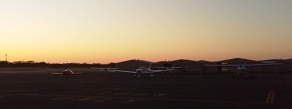 I packed, did the pre-flight, warmed up the engine and was ready to go by 7:15. I departed runway 18 and set a course of 154º for Ouyen, roughly following the Calder Highway at 1500 ft until a large forested area required discretion and a climb to 3500. This solar array 15 nm south of Mildura was photographed from 1500 ft.
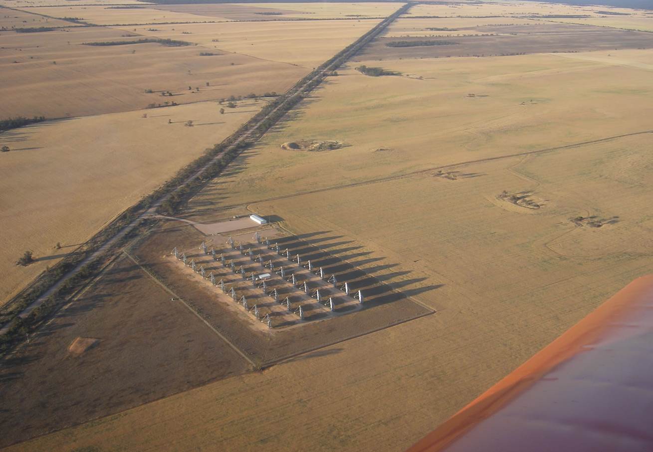
Only 25 nm south is this amazing area of salt lakes covering an area of nearly 400 square kilometres. 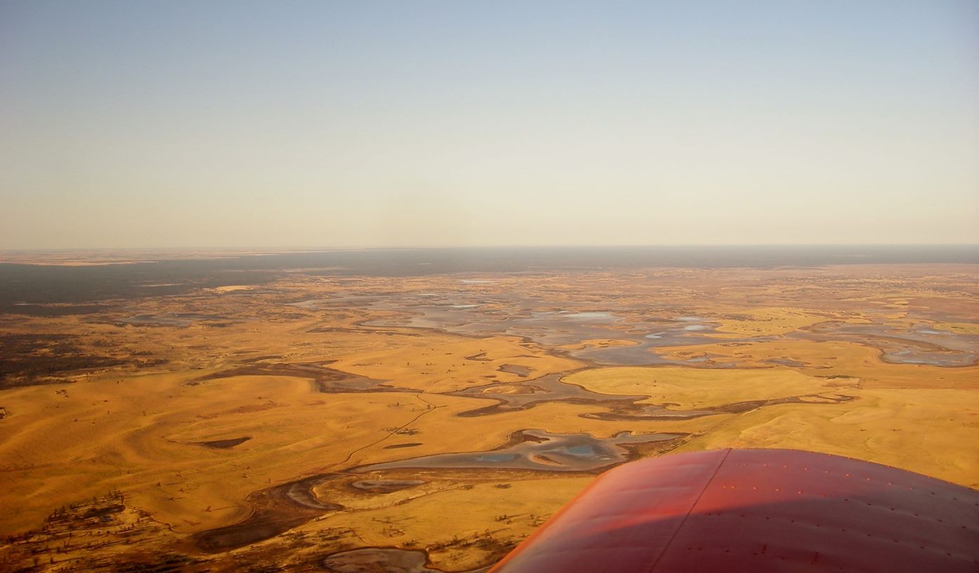
 About half of these fall within the Murray Sunset National Park but they seem to have defied the map-makers. Except for Spectacle Lake, one of the smaller ones near Hattah, none of them seem to have names. At Ouyen I changed course to 121º for the town of Sea Lake, a little to the south of Lake Tyrrell from which I assume it gets its name. Immediately
  south east of Ouyen is this enormous mineral sands strip mine. The longer of these is around 10 km. The sand is sent to a plant in Hamilton where they extract ilmenite and rutile, both oxides of titanium
 As I approached Lake Tyrrell there was a strong glare from light apparently reflecting off the water, but once I reached the lake it was obvious that once again the lake is salt. Are you seeing a pattern here?
 At Sea Lake there was another small course change to 130º for Bridgewater and a climb to 5500 ft. It wasn’t until I was within 15 nm of Bridgewater that the plains started to give way to hills. Time for a last course change to 135º for the 20 minute leg to Kyneton.
Off to the left is the old gold-mining city of Bendigo. Off to the right is the old gold-mining town of Maldon and another gold-mining town of Castlemaine. Well, you can see the pattern. It’s good country but a place where it’s easy to fall down a hole. As I passed Castlemaine I put the nose down and let the Sonex have its head. By 9:10 I was sitting in front of my hangar and thinking “What a beautiful day. It’d be nice to go for a flight”.
Summary of trip
Fuel use is in litres/100 km as is used in Australia for car fuel consumption. The inconsistency of units elsewhere is a reflection of our mix of units in Australia.
Fuel stop Fill litres Distance Time Fuel use
Naracoorte 35.43 186 nm 105 min 10.3
Goolwah 21.83 131 62 min 9
Jamestown 27 151 nm Not recorded 9.65
Mildura 34.25 194 nm 93 min 9.5
Kyneton 35 218 nm 105 min 8.7