Click on any image for a larger view
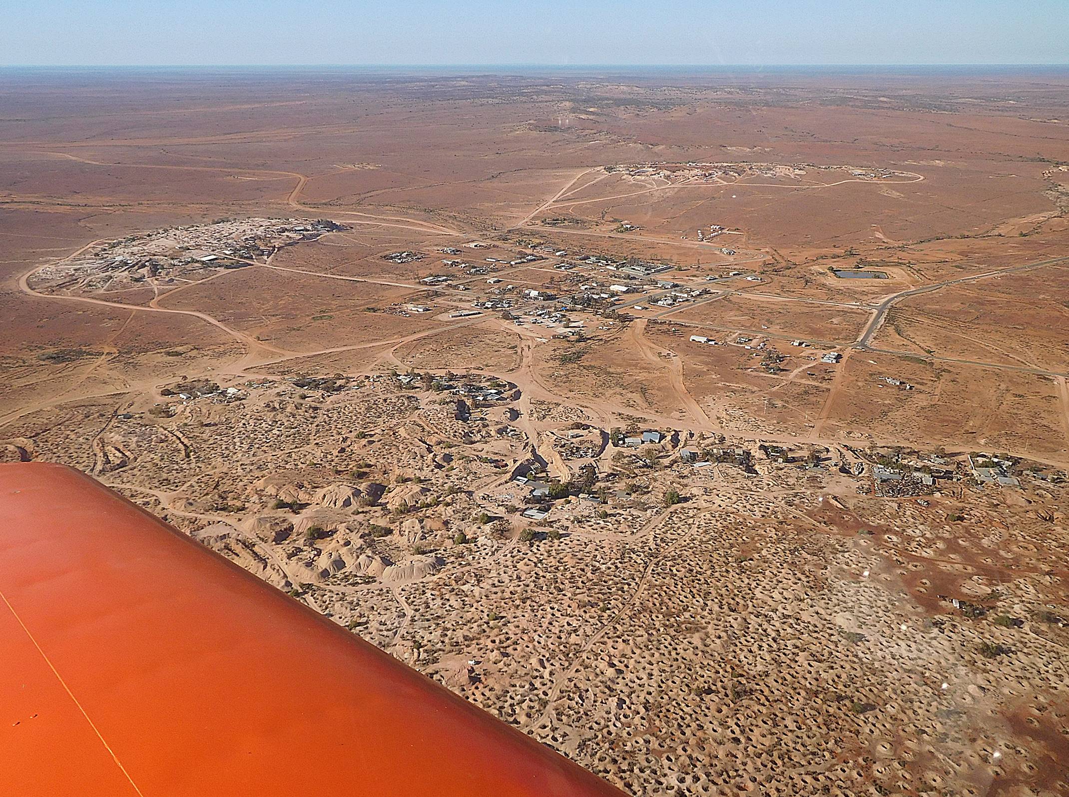
Using my fabulous organizing skills I emailed everyone I could think of and suggested a winter fly away to White Cliffs in western New South Wales. Other than phoning the hotel to book a few rooms that was about it for the organizing. We had a few people who were held back by work commitments but finished up with four Sonexes and six people traveling to this tiny outback mining community. Why White Cliffs? Well, it is a similar distance from most of the major population centres in eastern Australia. What is it? White Cliffs is an opal mining town that has been mined continuously since 1888 when the first opals were accidentally discovered there. At one time it had a population of 3500, but the permanent population now is 103, and most of them live underground as a way of avoiding the severe summer temperatures.
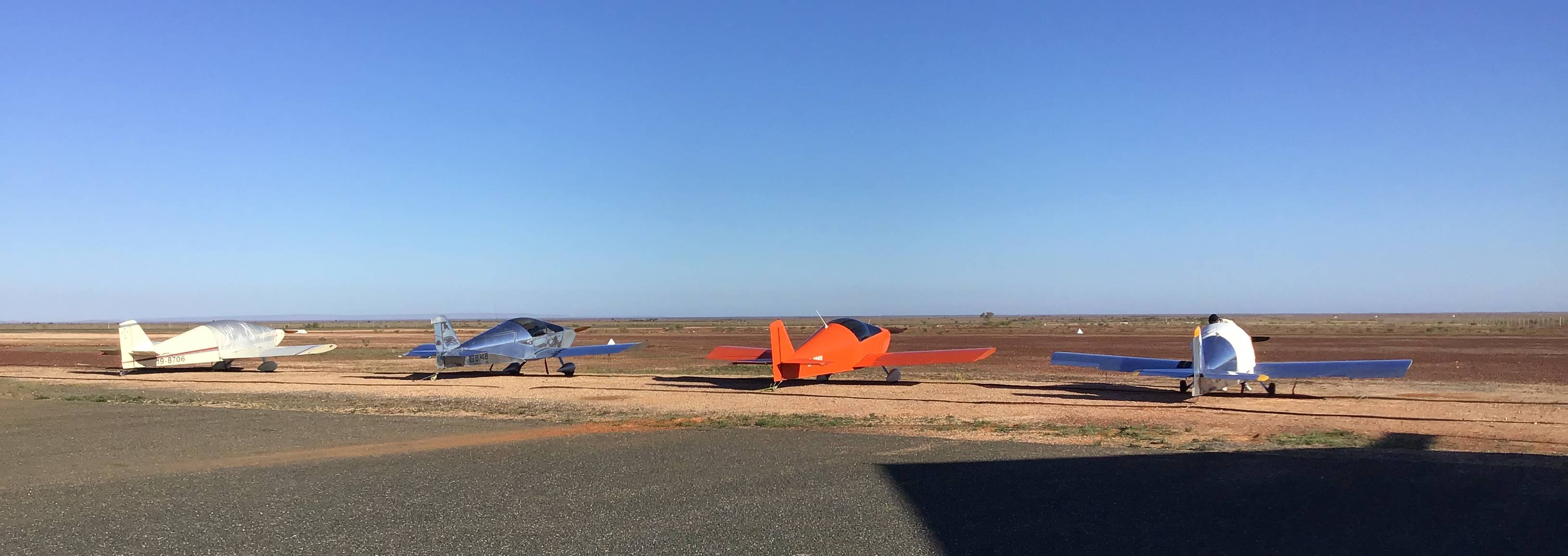
The four takers were:
Phil Bird from Mittagong with his passenger, John Haren
Steve Woodham from Port MacQuarie
Adrian Clout from Bathurst with passenger Peter Edkins
Peter Anson from Mount Macedon
The idea was to fly there on a Tuesday, spend a day and a half looking around and fly home on Thursday, but the weather forecast for me gave me a window to leave Kyneton on Monday and return Thursday (with luck). Phil was also worried about getting out of Mittagong so we agreed to meet at Narromine on the Monday. This was a bit (lot) out of my way but after all, this was flying for fun, not because we had to be somewhere.
Kyneton to Temora, 226 NM
This is almost a direct track, with just a small kink at Heathcote to take me away from the Puckapunyal military area. Heathcote, just 23 NM north east of Kyneton is a small town with quite a few vineyards and incongruously, a drag strip. Drag racing is not one of my interests but the beautiful shiraz they produce around Heathcote definitely is. “Heathcote Shiraz” is almost synonymous for good quality red wine so I had imagined vast vineyards of the stuff, but it’s not so. They cover only a fairly small proportion of the surrounding country. A little further on I cross the Waranga Basin reservoir, a lake completely enclosed by an airspace danger zone up to 2500 ft for use as a UAV test area, and a final slight turn at the dairy town of Tatura. For some reason dairy towns don’t excite my interest quite as much as wine towns, but there you go. Winter rains have brought the country to life and while it’s not European green, it looks pretty green to Australian eyes. There was only a light head wind and I made pretty good progress as I crossed the Murray river between Yarrawonga and Cobram and after less than 2 hours I made a cross wind join for runway 36 at Temora.
The main thing of note about Temora for us is the Temora Aviation Museum which houses a nice range of flying historic aircraft, but here’s another take on Temora:
A fellow who moved to Temora
Met a lady and he did adore ‘er
But it wasn’t a joke
To find “she” was a bloke
And he blushed every time that he saw ‘er
Distance: 226 NM
Time: 2.01 hours
Fuel used: 39.9 litres at $2.278/litre
Average speed: 112 knots
Temora to Narromine 137 NM
I followed a direct route between the airfields so didn’t pass over any of the towns but there are a couple of notable landmarks along or near this route. One is the North Parkes gold mine which appears to consist of 3 large holes in the ground and 5 large tailings dams. A more interesting landmark is the Parkes radio telescope, which was not on my direct route but which I have visited before. Seeing we are celebrating the 50th anniversary of the first Moon landing it’s worth noting that most of the images we saw of Neil Armstrong and Buzz Aldrin on the moon were relayed by the Parkes telescope, although the first few minutes of Armstrong setting foot on the moon were from Tidbinbilla, near Canberra.
As I flew over Narromine I could see Phil Bird’s white Sonex parked, and he and John had already booked us a cabin in the camping ground, worth having as the temperature overnight was expected to get close to freezing.
Distance: 137 NM
Time: 1.26 hours
Fuel used: 25.08 litres at $2.37/litre
Average speed: 108.7 knots
Narromine to Cobar 131 NM
There was no reason to rush in the morning. Steve Woodham was hoping to leave Port MacQuarie by 7AM and reach Narromine by 9, but a quick repair to his elevator trim and a light headwind meant he didn’t arrive until closer to 10. Meanwhile, Adrian was heading directly to Cobar from Bathurst. Phil headed off first with the two 3300 powered aircraft following soon after.
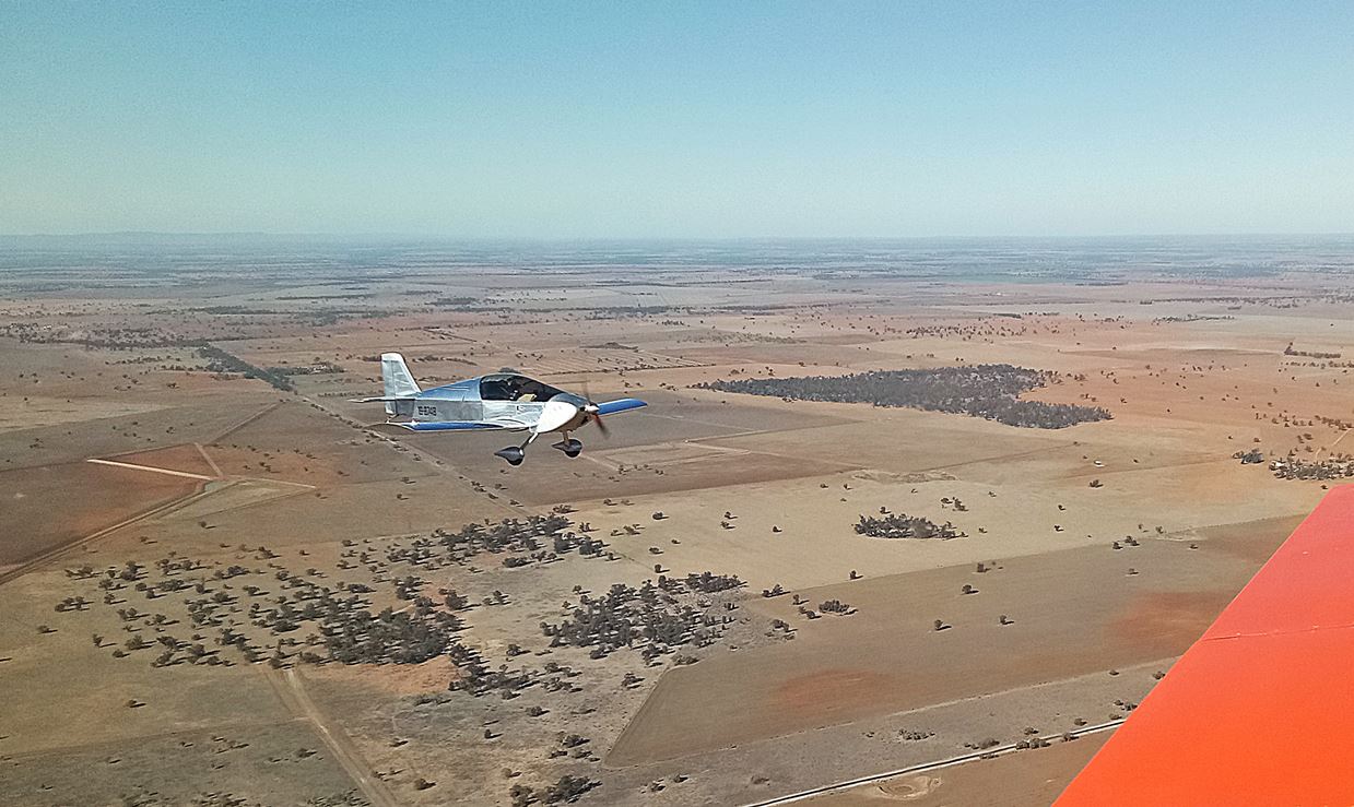
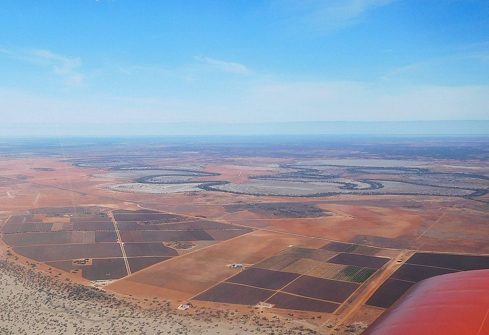
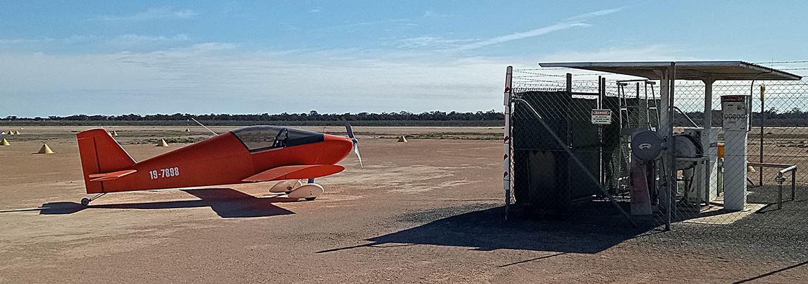
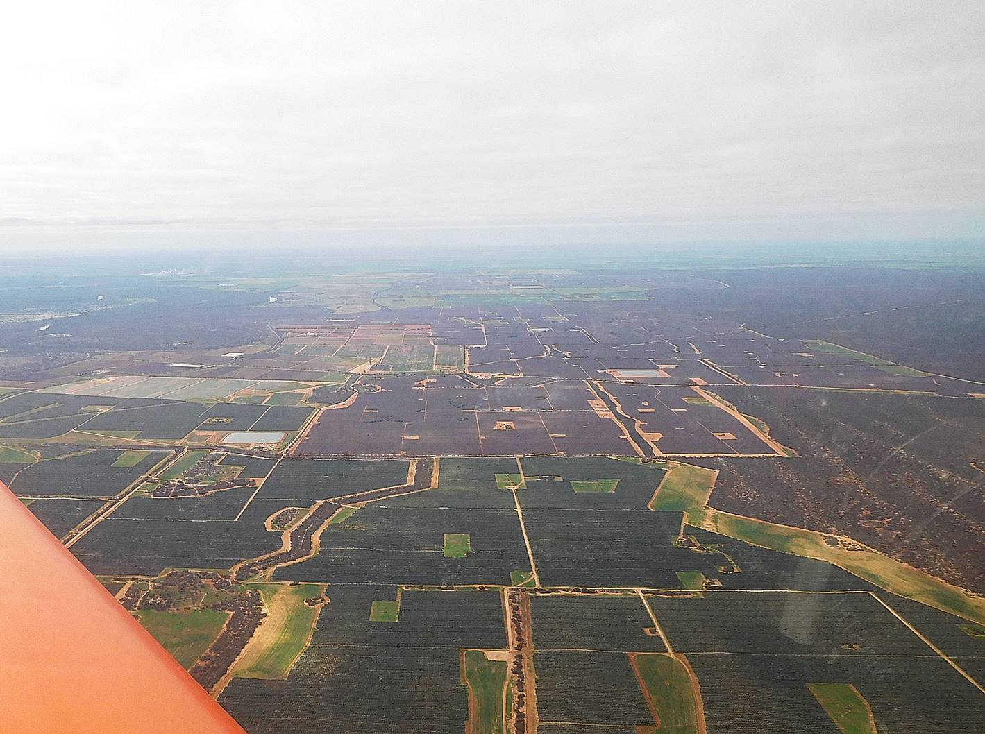
As we headed west first the green faded from the grass and then the grass failed so that while we were still flying over farmland and plowed fields, it was mostly just the red earth. We kept to 2500 feet because the forecast headwinds increased with altitude, but when the open fields and dirt tracks turned to scrubby trees and very rare open spaces we climbed to 4500 feet and found that the winds were no worse. At Cobar the wind slightly favoured 35 but was gusting over trees so that after I had done my usual 3 point landing I suddenly found myself flying again. Does that count as one landing or two? At the fuel pump we lined up behind Adrian who had beaten us by a few minutes but didn’t waste too much time socializing before heading off on the last leg to White Cliffs. Phil, Steve and I were all a little concerned about landing at Cobar because it is a security controlled airport and Steve’s ASIC (Airside Security Identification Card) had expired and he hadn’t received his new one, my ASIC had expired in June and I hadn’t yet applied for a new one and Phil had never owned one. Would they be officious bastards demanding the correct ID? After refueling I went to the security gate for access to the little terminal building and noticed that the gate code was written in permanent marker on the air side of the gate. Not wanting to forget the code I took a snap with my phone but as I went through the gate I noticed that it was also written in permanent marker on the public side of the gate. I guessed that they wouldn’t be hasseling us for ID.
Distance: 131 NM
Time: 1.21 hours
Fuel used: 25.67 litres at $2.28/litre
Average speed: 108.3 knots
Cobar to White Cliffs 150 NM
We were now heading out into a remote region. There are farms out here but they are scattered enough so that they are all marked on the map, and usually 20 to 30 km apart. Steve and I took a heading of 260° which kept us within sight of the Barrier Highway for the first 67 NM but inevitably had to strike off into the nothingness for the last 83 NM. After about 30 NM on this leg we crossed the Darling River which looked spectacular from the air because it is surrounded by a huge flood plain which is visible from miles away.
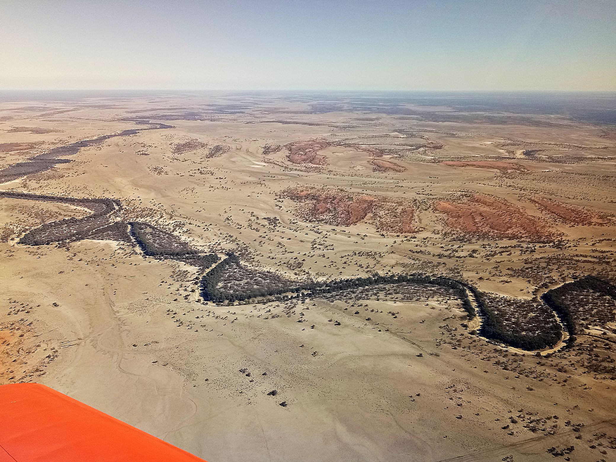
The Darling was the only significant landmark on our route and you might think that would pinpoint our location accurately but the River is over 1400 km long. Give thanks to GPS. The headwind gradually increased over this leg but at least our runway choice was easy. We tied down next to Adrian’s parked Sonex and Phil arrived soon after. By the time we had unpacked, a woman arrived to give us a lift to the pub.
Distance: 150 NM
Time: 1.45 hours
Fuel used: 29.5 litres at $3.35/litre*
Average speed: 103.4 knots
*For all those US citizens who think avgas is expensive there, this is equivalent to nearly US$9.00 per gallon.
First impressions of White Cliffs
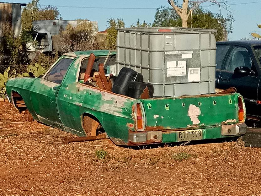
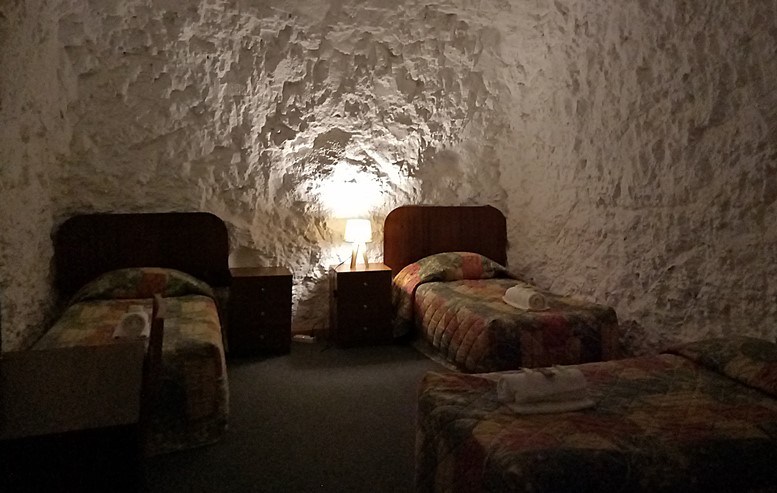
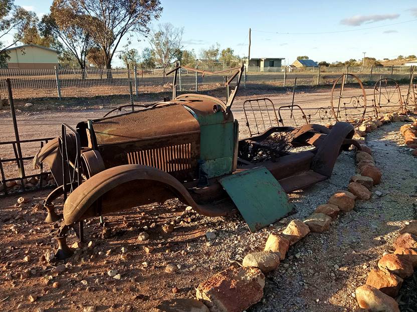
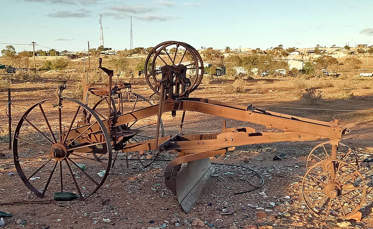
Well, I have to admit that my first impression was that this place looked like the end of the earth. I have never seen so many wrecked cars, trucks and derelict pieces of machinery in one place before. It looks like the set of a Mad Max movie, however the greeting in the pub was friendly, the beer was cold and our rooms, while spartan, looked clean and comfortable. The meals were good quality pub fare and reasonably priced.
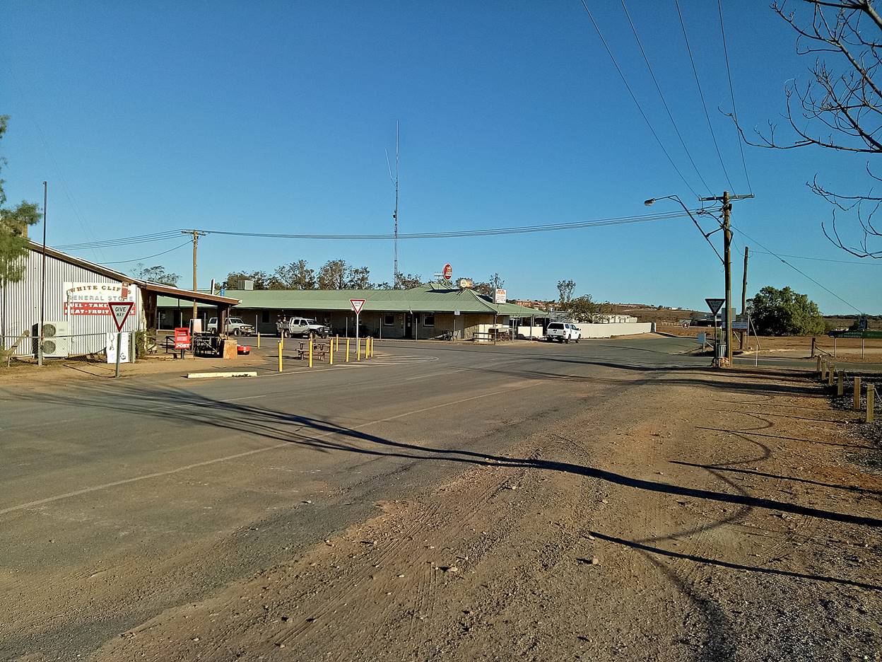
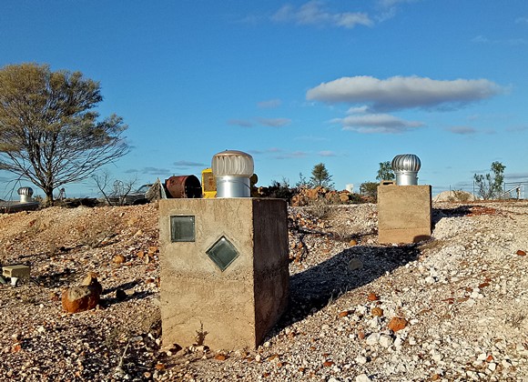
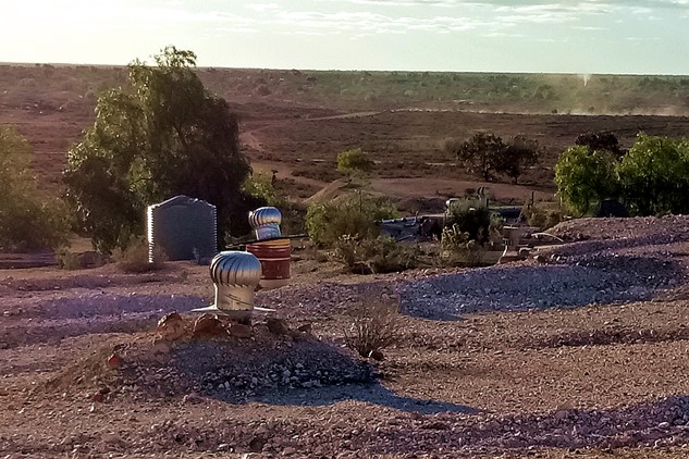
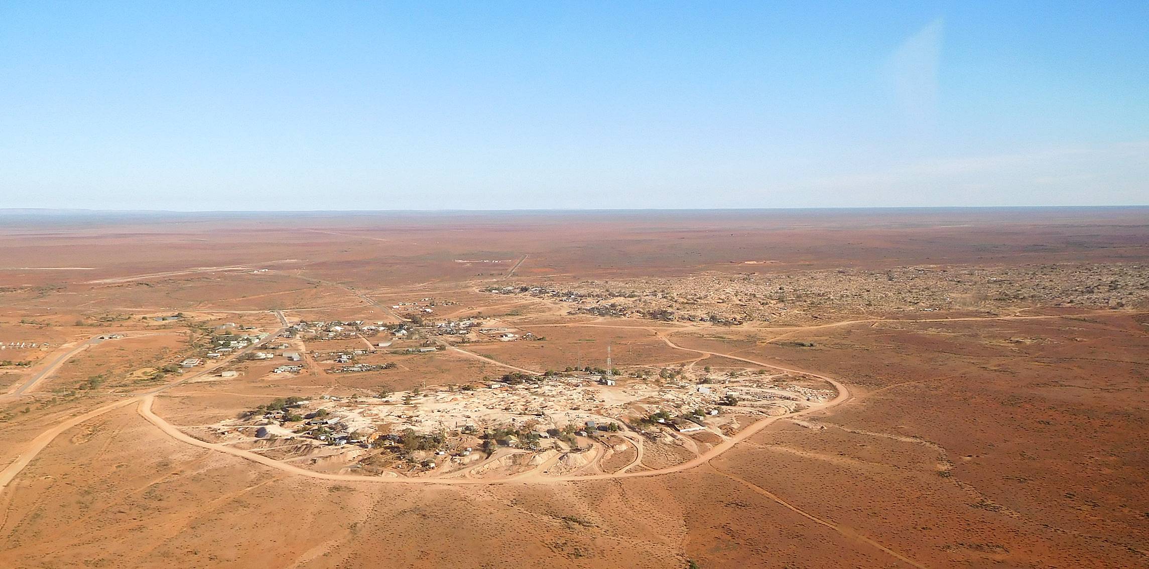
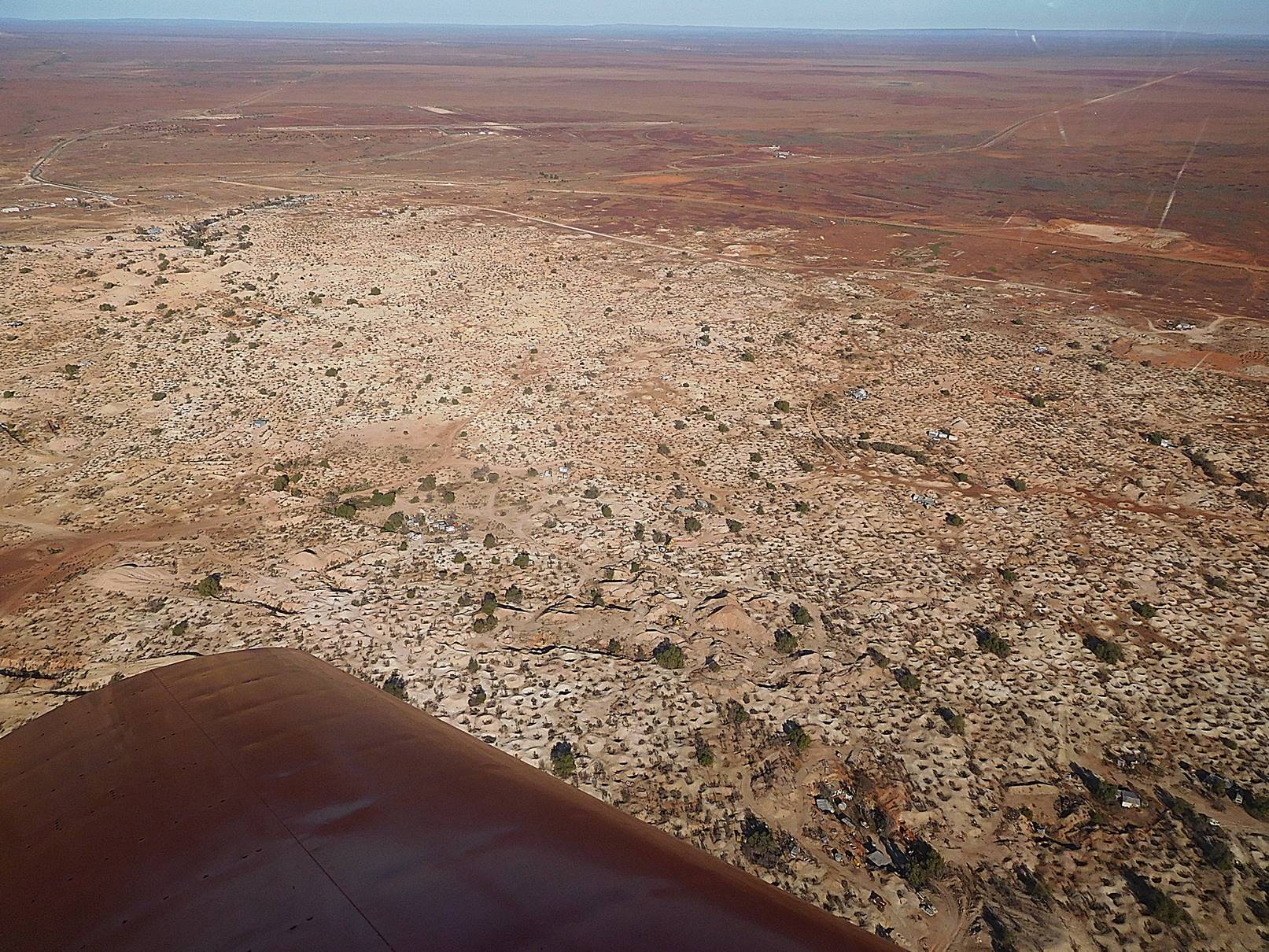
White Cliffs is a small village surrounded by three low hills, the main opal field to the north, Smith’s hill to the south and Turley’s hill to the east.
Opals have been found in the northern and eastern hills, but not in Smith’s hill, so that has become a sort of underground housing estate; if you get an allotment there you can dig your own house. There are also underground houses on Turley’s hill which has been extensively mined and the southern end of the northern hill, which is by far the largest mining area. Mining claims are 50 metres square and nobody can own more than two claims. Most claims are worked by one person and because it is done on a small scale, most miners use devices like this automatic bucket unloader or a giant vacuum cleaner to help excavate.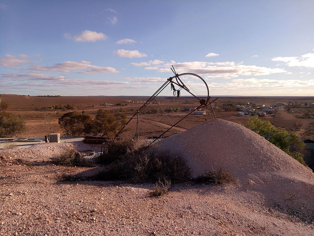
I think the process they use is to drill a small hole and if the core samples look promising, dig a proper shaft. The place is covered with thousands of holes, not all necessarily filled in so you don’t want to go walking in the mining areas in the dark. Opals by weight are worth about 10 times the value of gold, so it is potentially lucrative.
Wednesday
We hitched a lift out to the airfield at about 8:30, Steve for an early departure back to Port MacQuarie via the Darling River and Bourke, Phil to retrieve a Jerry Can so he could fill up with mogas in town and Adrian to help me do a bit of trouble shooting on my Sonex. My voltmeter had been indicating only 12.5 volts on the last leg of the journey and I might have to charge the battery just to get home. I carry a good range of tools while traveling but only a very simple voltage tester. Fortunately Adrian was better equipped so we checked the AC from the alternator and it was OK. Good start. Next we checked the DC from the regulator and suddenly it was all OK. Adrian’s diagnosis was a dodgy connection which I accidentally cured by forcing the probes into the back of the plug. He is pretty likely right as I had no problems on the trip home. We refitted the cowl and started walking back into town where we were supposed to meet a tour bus, but this being a little country town, the tour bus came to meet us. Our bus driver guide was really well informed and most of what I now know about the place came from his commentary.
Underground living
The advantage of living underground is a stable temperature all year round without the need for heating or cooling. Our guide said that his “dugout” never got colder than 18°C or hotter than 25°C. The earth at White Cliffs is very stable. None of the underground rooms I saw had any sort of reinforcing and apparently no one has ever been killed by a cave-in there. One interesting aspect of this that I didn’t enquire about was building regulations. I have recently added a room to my own house and it cost me thousands just applying for permits and getting inspections. I suspect White Cliffs is frontier territory here but if we all started building underground you can bet that rules and regulations would soon follow, probably necessarily.
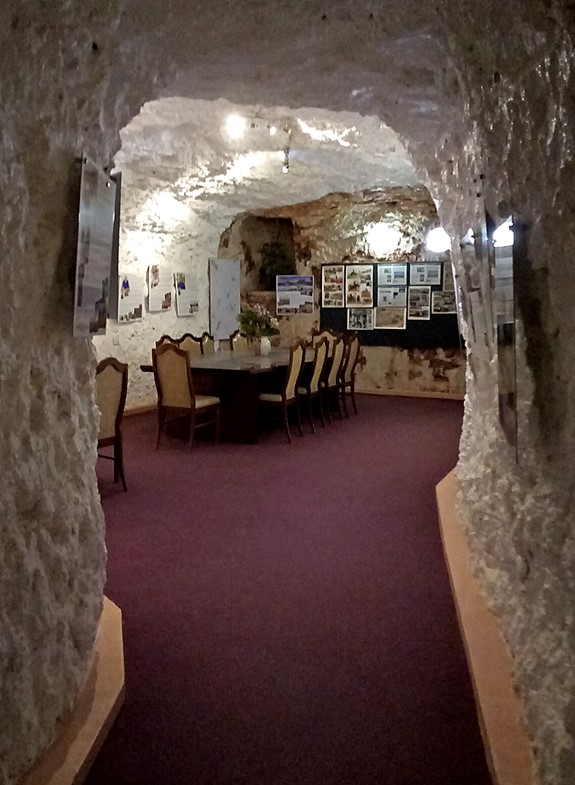
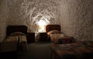
Our tour took in two places, a fairly luxurious house and the motel. All the house photos are from the following web site: http://www.whitecliffsnsw.com/Underground.html
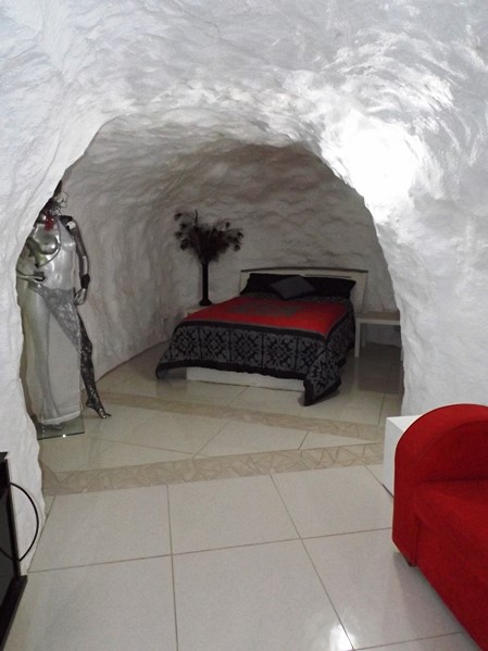
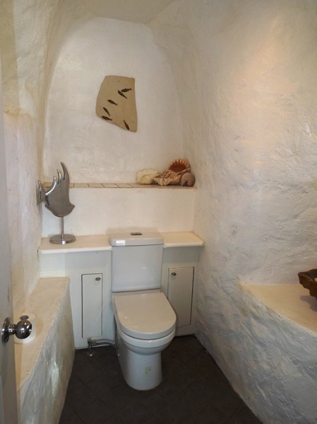
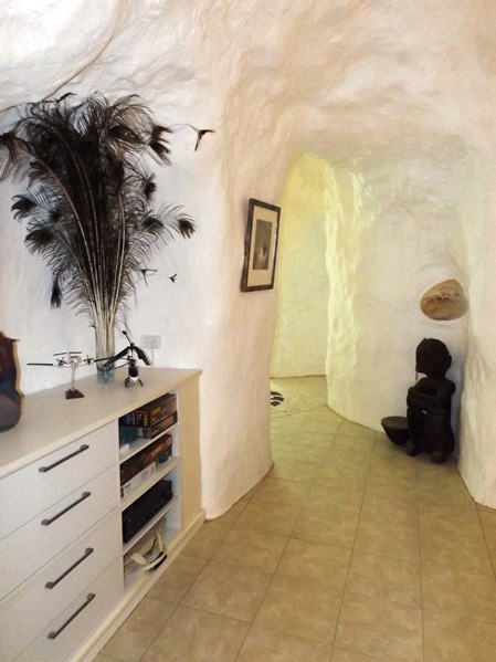
We didn’t stay at the motel as it was a more expensive option than the pub, but if I went there again it would be to stay in the motel, just for the experience of sleeping in a cave but in a comfy bed.
 Queer and quirky
In the afternoon I went for a walk to Turley’s hill and took the following pics. Most were taken while I was walking on somebody’s roof top.
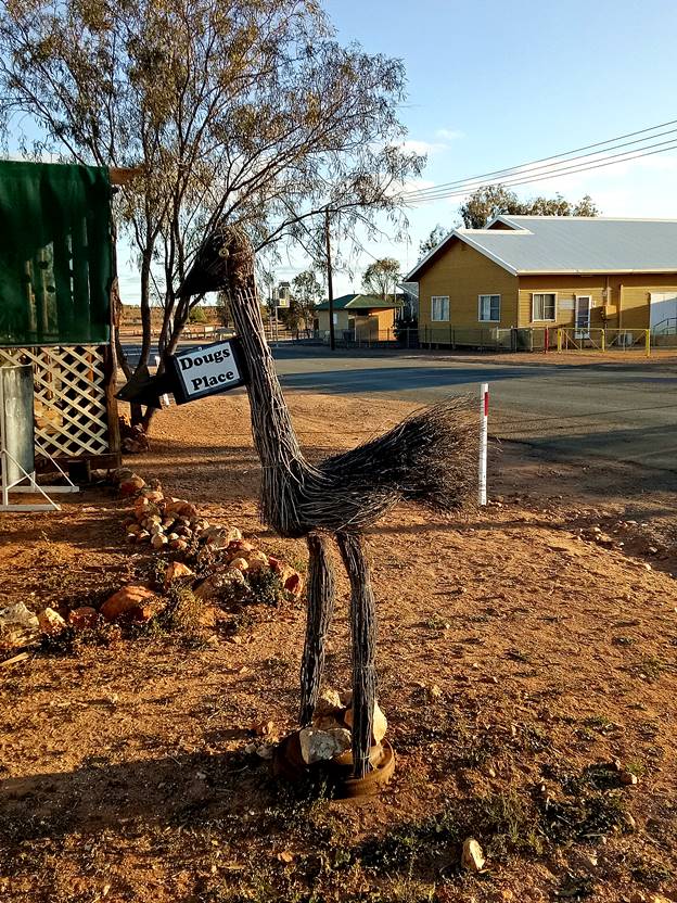
Back in the village I came across Doug’s place, either an outdoor museum or an area of pleasantly arranged junk.
 Back to the pub for a drink and a meal: It was astonishingly busy for such a small population on a Wednesday night. I can recommend the grilled barramundi (an Australian species of fish for you furriners) and the salads were delicious.
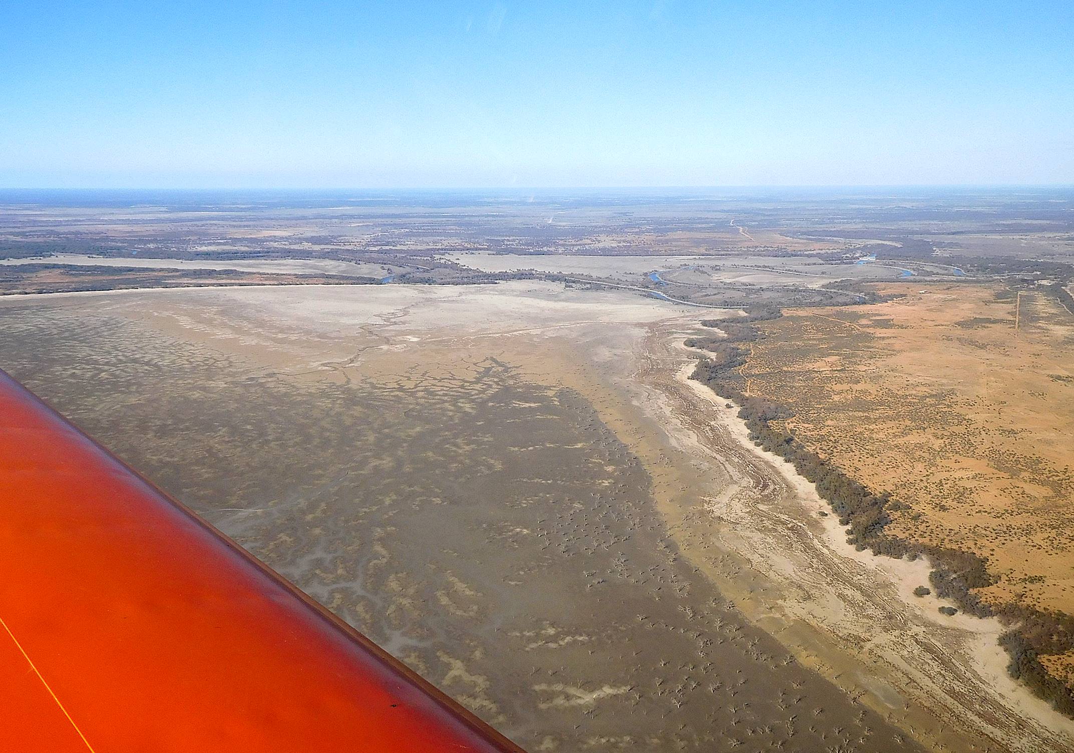
White Cliffs to Wentworth 197 NM
On Thursday morning, we loaded our gear into the pub’s truck and once again they obligingly carted us to the airfield. This time we were all heading in different directions, in my case via Wilcannia, the Darling River and Menindee lakes and the last bit of desert down to Wentworth. The others had a light tailwind heading east but my southerly route would be into light headwinds, at least until Wentworth, so I planned to stay at 2500 ft unless the country dictated a higher altitude. We all took off from Runway12 and did a circuit around the area before heading off. I checked in on the chat channel and could hear the others for a considerable distance, well after Wilcannia.
I had an interesting experience on the leg between Wilcannia and Menindee. I use Ozrunways on my iPad for flight planning and navigation. One of the features is that if you are within range of the mobile phone network it will “broadcast” your position and planned course and altitude to other Ozrunway users and display it on their screens; almost as good as radar but with a bit of a delay. The mobile network is very limited in the outback but at altitude it’s surprisingly good. While heading south west roughly parallel to the Darling River I could “see” another aircraft tracking east across my path but marked as “unidentified”. He was only 300 feet higher and as we closed it looked like we might pass pretty close to each other so I kept a close watch on our altitude separation, and when it looked like I might be able to spot him I looked in the likely direction and was surprised to see a large helicopter, I think it was a Bell 412 air ambulance, within a few hundred metres and closing rapidly. We did have a safe altitude separation but I think he got a bit of a shock too because he made a sudden bank to the left to pass behind me. We were probably the only aircraft within a 100 mile radius but we came that close. Sometimes the big sky just isn’t big enough.
At Menindee the lakes were effectively empty, with just a small amount of water in Lake Pamamaroo. These lakes are the water supply for Broken Hill so they must be drinking beer and bathing in sand at present and only one of those things is good.
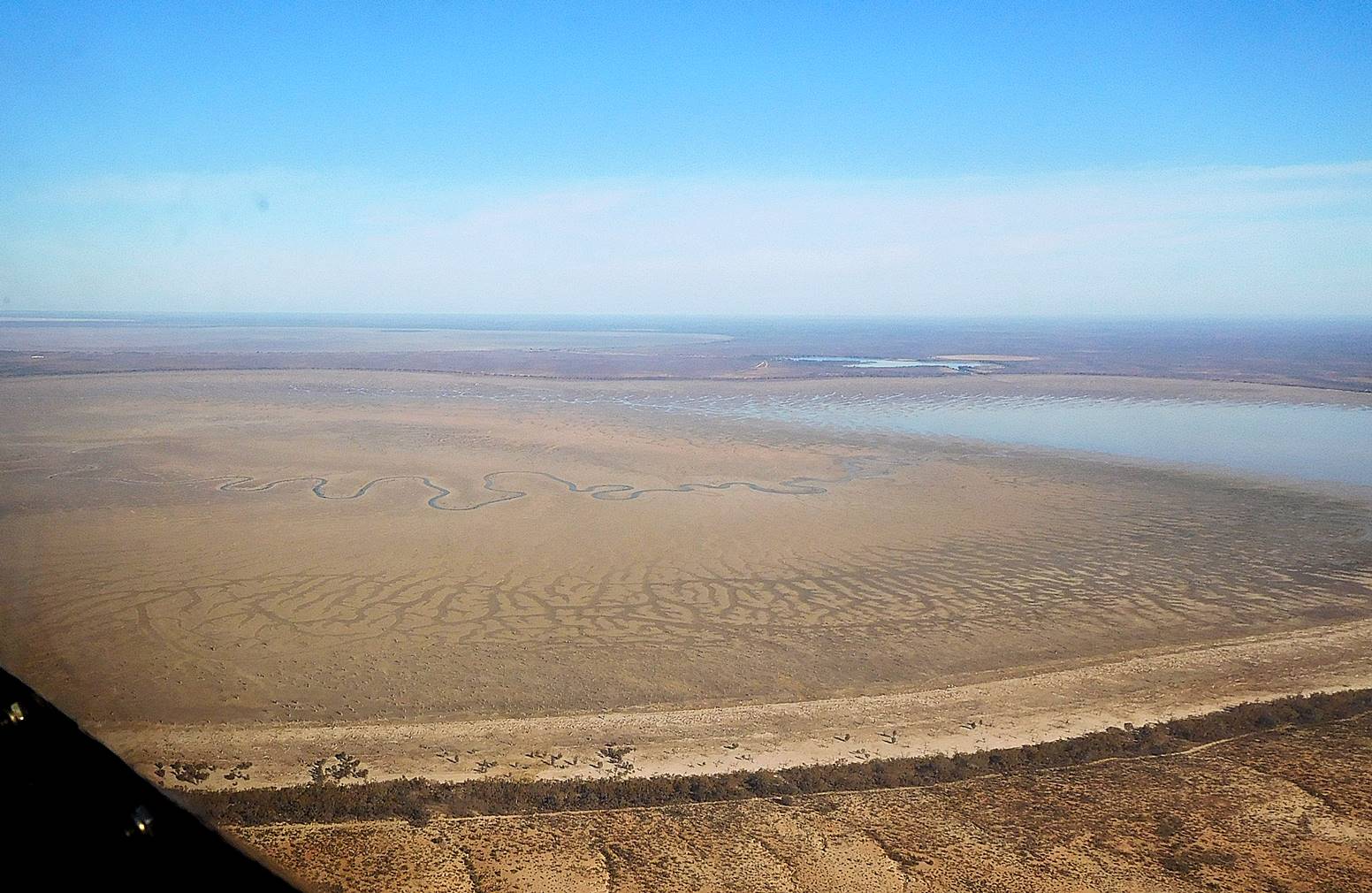
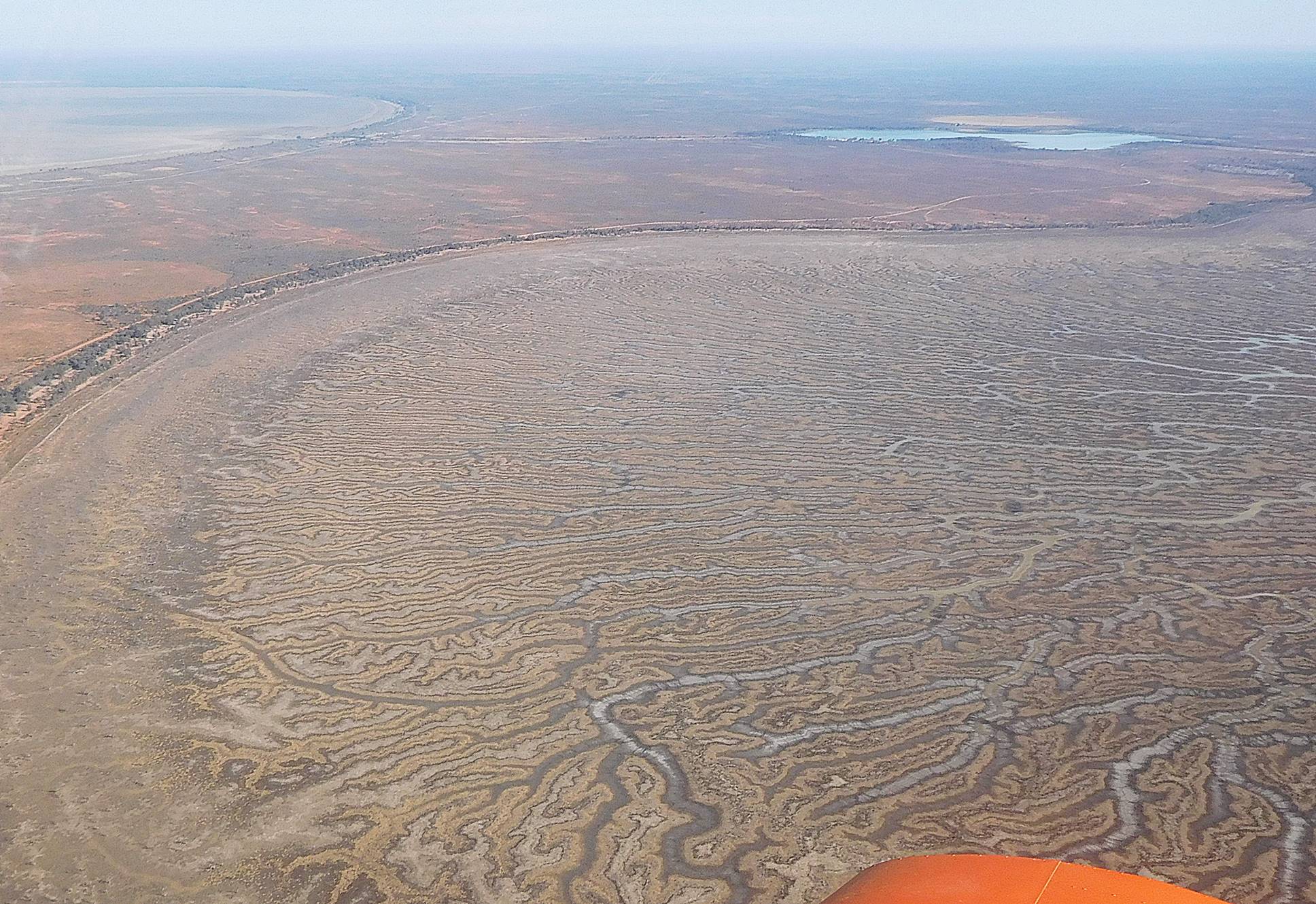
At Lake Tandou, where I made my turn onto the last leg and climbed to 3500 ft I was disappointed to find the “lake” as dry as all the other farms I had seen. There are nominally about 20-odd lakes along this leg but they are all dry and it wasn’t until I approached Wentworth that there was any real life in the land.
Distance: 197 NM
Time: 1.85 hours
Fuel used: 38.44 litres at $2.41/litre*
Average speed: 106.5 knots
Wentworth to Kyneton 226 NM
At Wentworth I had turned a corner onto a track of 134° and for the first time picked up a solid tail wind. I tried 5500 ft for a short time to see if I could pick up the forecast higher winds but there was no advantage and I was soon forced to descend under a layer of cloud. It was good to see some green again, the benefit of the winter rains, and even the Mallee, the dry north western corner of Victoria was verdant.
Fortunately there was little turbulence associated with the cloud so I had a smooth ride with a ground speed of about 135 knots which started to feel quite fast as I was approaching Kyneton at 600 feet AGL, necessary to get under the lowering cloud.
Distance: 226 NM
Time: 1.75 hours
Fuel used: 34.2 litres
Average speed: 129.1 knots
Totals for the trip
Distance: 1067 NM
Time: 9.53 hours
Fuel used: 192.8
Average speed: 112 knots
Fuel burn: 20.23 l/hr (5.34 gal/hr)
Here’s a little side story about a recent experience with Ozrunways. I mentioned earlier that users can keep track of the location of other aircraft, but there is also a web site, https://tx.ozrunways.com/ where you can check the location of any aircraft that is broadcasting its position. On a recent trip to Queensland by airliner, I had my iPad running Ozrunways. The iPad was set to flight mode of course but I like to be able to identify landmarks and location and if I have a window seat it can usually pick up enough satellites to get a fix. I had also logged into the plane’s wifi which is pretty new on Australian flights, and happened to open the Ozrunways tracking site where I noticed an aircraft in a similar location to ours. It was Sonex 19-7898 doing 420 knots at 36,000 feet, surely a speed and altitude record for a Sonex. Take that you RV flyers!
I really enjoyed the trip and going by the comments from the others, they did too. I even got to appreciate a grubby little mining town in the middle of the desert. Thanks to Steve, Adrian, Peter, Phil and John for their company and conversation.
But wait, there’s more
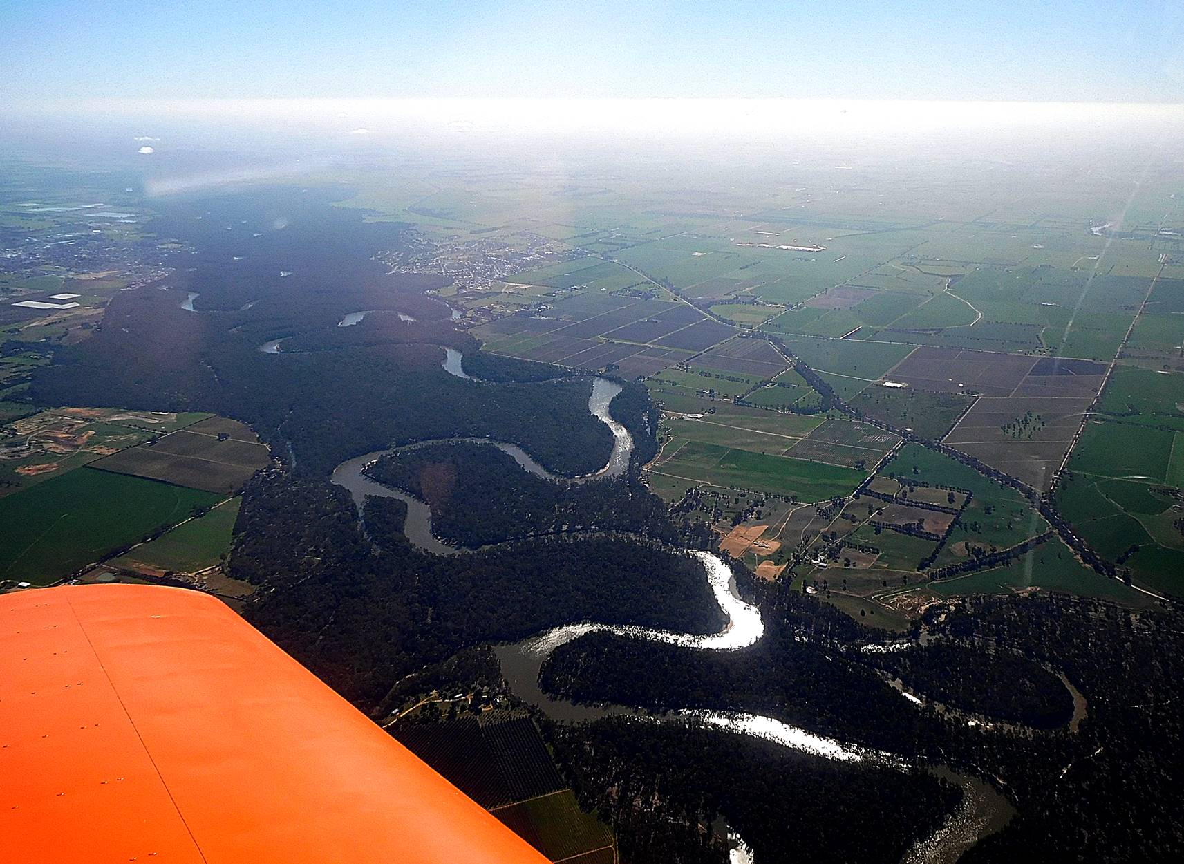
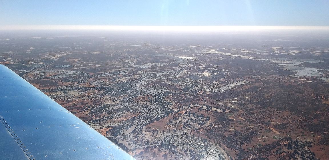
Steve sent me the following photos, taken on his return flight to Port MacQuarie. The first leg of his trip was to Bourke, about 160 NM ENE of White Cliffs. In that 160 miles, the country went from desert to floods and back to drought. Here are floodwaters at the Paroo Overflow (we think) just 50 Nm from White Cliffs.
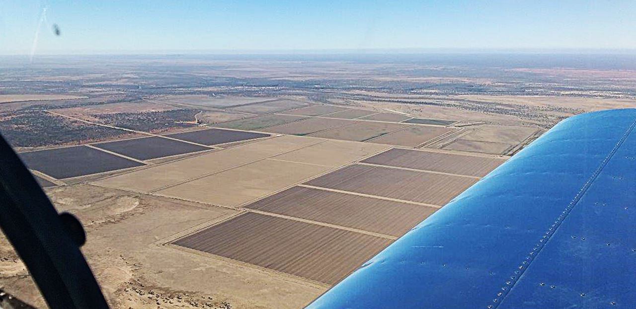
Closer to Bourke are these plowed fields, just hoping for some rain
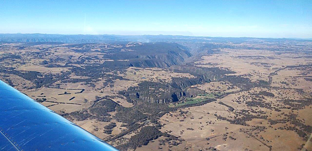
The Great Dividing Range runs the entire length of eastern Australia, but most of it isn’t mountains like you may think of them. Even the highest Australian mountains are so old that they have been eroded to plateaus or round tops. At Mount Hotham, a ski resort in Victoria, an odd effect of the shape of the mountain is that all the beginners slopes are at the top of the mountain while the more challenging steep slopes are lower down. Steve took the following photo from 7500 ft but the land below him is 3500 feet. This gorge is about 60 Nm west of Port MacQuarie.