This trip started with a phone call from my son-in-law, Ricky. “Would you be interested in doing a flight to Arkaroola?” was answered with “Where the hell’s Arkaroola?” I had never heard of it but it’s a private nature reserve in the northern part of the Flinders Ranges in South Australia. Ricky is a free-lance writer and he had a gig writing about Arkaroola for one of the adventure/travel type magazines, but was rather dismayed to find that according to Google it was either a 17 hour drive from Melbourne or a flight to Adelaide followed by an 11 hour drive. If I could fly him in the Sonex he could get me paid accommodation. I had never been to the Flinders Ranges and it sounded like fun so we started planning, bearing in mind that plan B was a flight to Adelaide and a long drive in a hire car.
Even in the Sonex this didn’t look like being a trivial trip. The 220 NM stretch from Kyneton to either Mildura or Wentworth on the Murray River is pretty straightforward, but from there to Arkaroola is a 270 NM crossing of very sparsely populated desert. A strong headwind could reduce my fuel reserve to zero with no viable alternatives. I decided that the best routes were either via Broken Hill, which still involved a 150+ NM desert crossing, or via Port Pirie, near the top of the Spencer Gulf and then north along the Flinders Ranges, which would add about 100 NM to the trip. We eventually went to Arkaroola via Broken Hill and returned via Port Pirie.
Click on any of the images for a larger view.
Kyneton to Wentworth – 227 NM
This leg is mostly over open farmland, and looking fairly green at this time of the year. I let Ricky take the controls and it was soon obvious that he could follow a more accurate course and altitude than I could. In my defence I’d like to say that I do more stuff than just follow a heading, but who cares? This was as good as having an autopilot, but a bit heavier.
The only memorable thing about the leg was that we pushed a headwind the whole way. This became less memorable later when we pushed headwinds for every leg of the trip. When we landed at Wentworth, it appeared at first that the fuel bowser was closed, but all was well; it was just hiding behind a closed gate.
Time: 1.99 hours Av speed: 114 knots
Fuel used: 41.37 litres Price: A$2.09/litre
Wentworth to Broken Hill – 127 NM
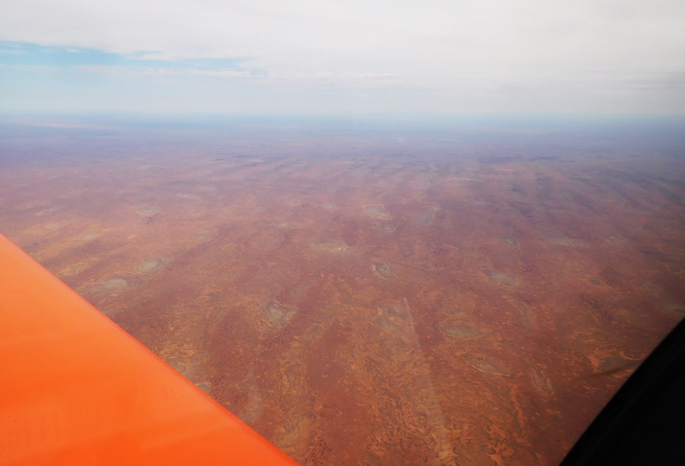
From Wentworth, it’s pretty much desert, but not entirely; there is a meandering river which appeared to have some water in it, the Great Darling Anabranch, a branch of the Darling River. They both flow into the Murray either side of Wentworth. There is also a series of ephemeral lakes, none of which contained any water at the time. Some lake beds appeared to have been ploughed, although from our altitude there was no obvious evidence of anything growing. 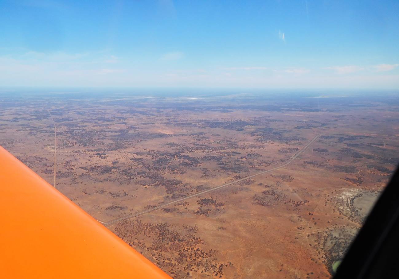 The road in the photo is our lifeline, the Silver City Highway to Broken Hill. Despite being pretty much in the middle of nowhere, Broken Hill is a large town, population about 18,000 according to Wikipedia and at the height of mining was much bigger. A rich lode of silver, lead and zinc was discovered there in the 1880s and the company which was formed to exploit it, Broken Hill Propriety is now, I think, the biggest mining company in the world. They no longer mine at Broken Hill, preferring to cause environmental disasters in other parts of the world.
Time: 1.13 hours Av speed: 112.4 knots
Fuel used: 25.23 litres Price: A$2.16/litre
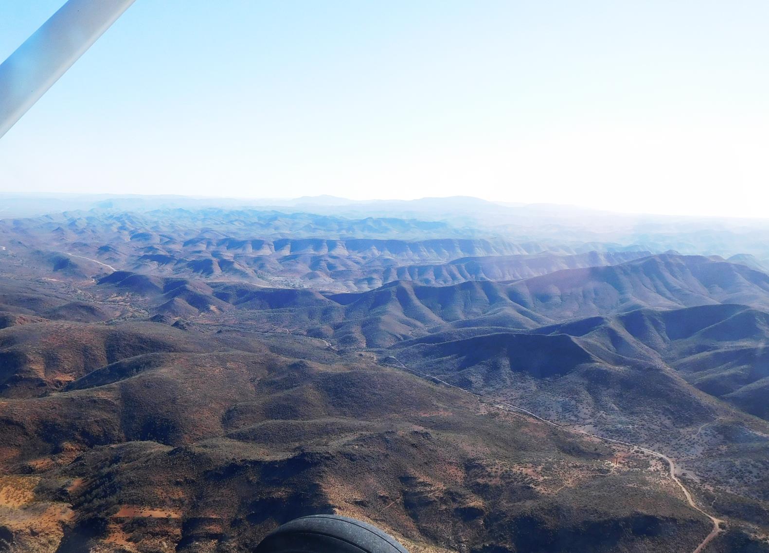
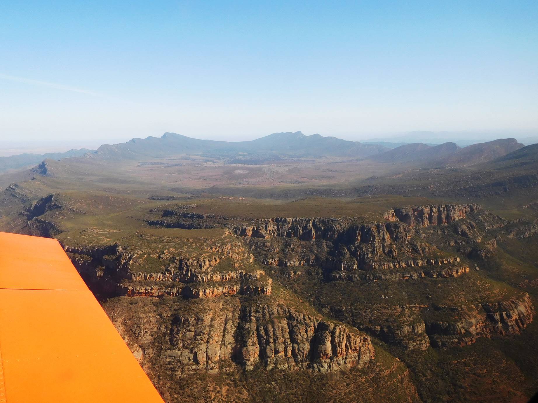
Broken Hill to Arkaroola – 155 NM
This was the part of the trip which concerned me most because if anything went wrong we really were going to be up that fabled flood of faeces. I had carefully checked the emergency locator beacon before our departure and we phoned Arkaroola with our expected arrival time, but this was a new level of remote for me. 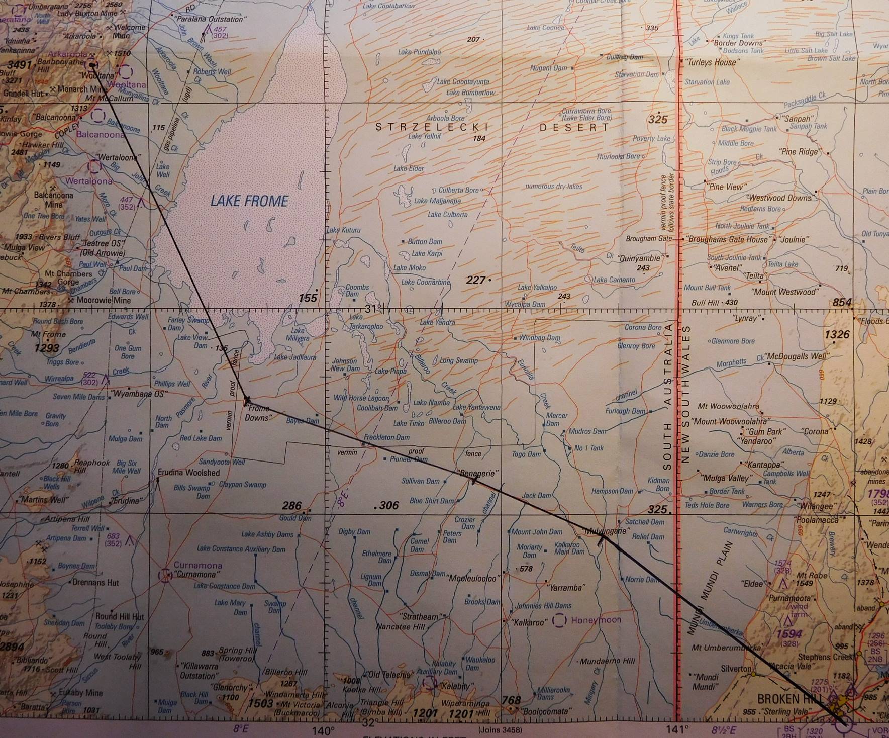 Here’s our course – 155 nautical miles with our turning points just three remote homesteads. By this time it was getting pretty warm and bumpy from thermals so we climbed to 8500 feet and I handed over to my “auto-pilot”. Two of the homesteads have airstrips which appeared as slightly lighter coloured red crosses on the red earth.
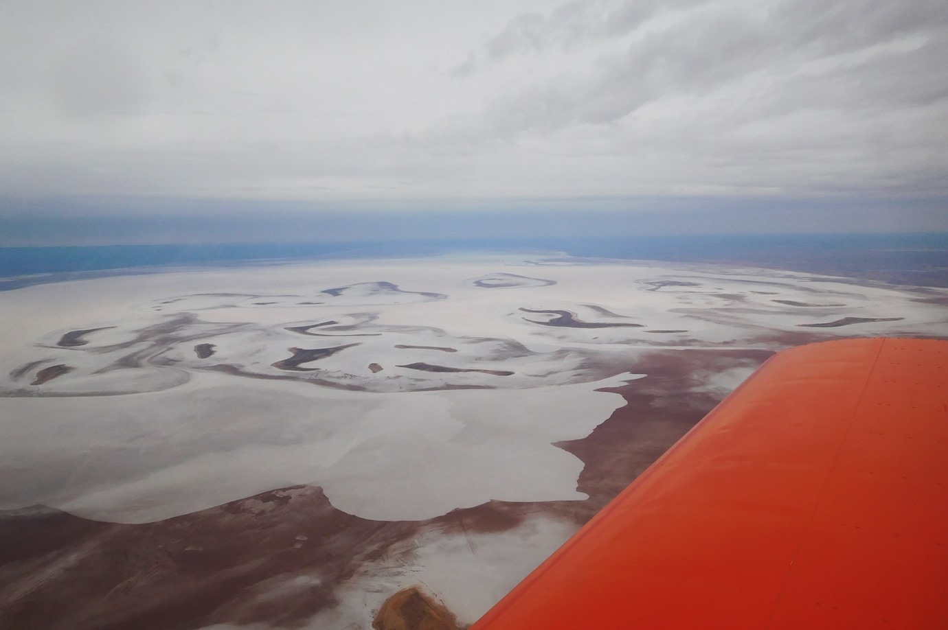
Lake Frome is a large salt lake and at 8500 we could see it from 70 miles away, even in the hazy conditions. The surface of the lake appears very smooth but apparently the salt is only about 30 cm thick and a couple of aircraft have landed on it with disastrous results.
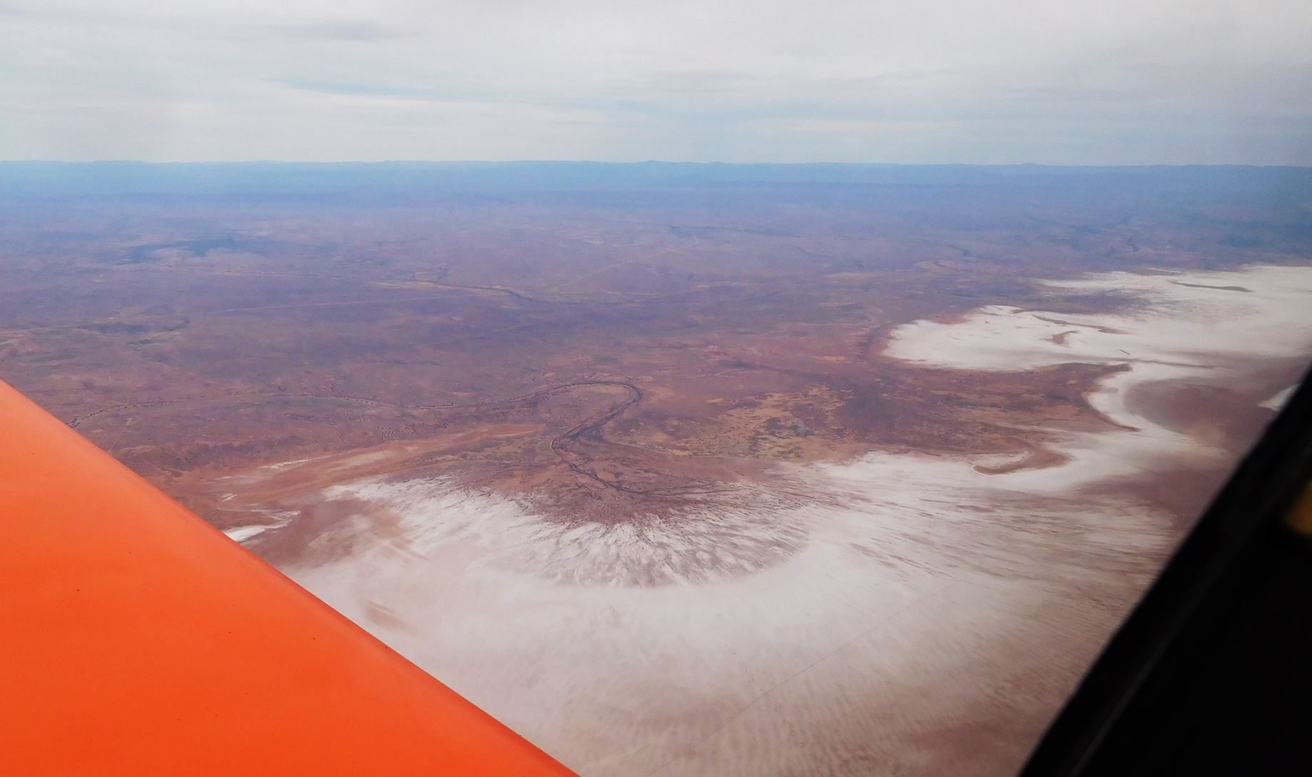
It rained heavily on Wednesday night and when we flew over the lake on Thursday afternoon it contained what appeared to be a lot of water but was likely to be only a cm deep.
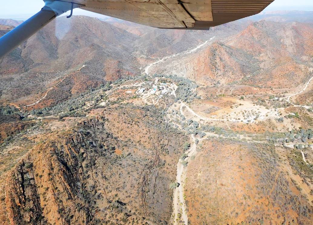
About 12 NM from Arkaroola we started our descent, picked up the wind sock and made a cross-wind join for 03. Base leg had us skimming the saw-tooth top of the nearby range and had me thinking “Hmmm, maybe I should be doing RH circuits on 03” (the answer if I had read ERSA properly is YES) but what a great view. Vicki was waiting for us and pointing to a large nearby hangar where there was plenty of room for the Sonex. Space is limited if you are flying in but we were lucky.
Time: 1.42 hours Av speed: 109 knots
Fuel used: 25 litres Price: A$2.60/litre
I didn’t think the fuel cost was too bad considering the remoteness of the location and the buying power of a small private airfield. By contrast, we later paid A$2.313/litre at Mildura, a large airfield with plenty of buying power and a not particularly remote location.
A bit about Arkaroola
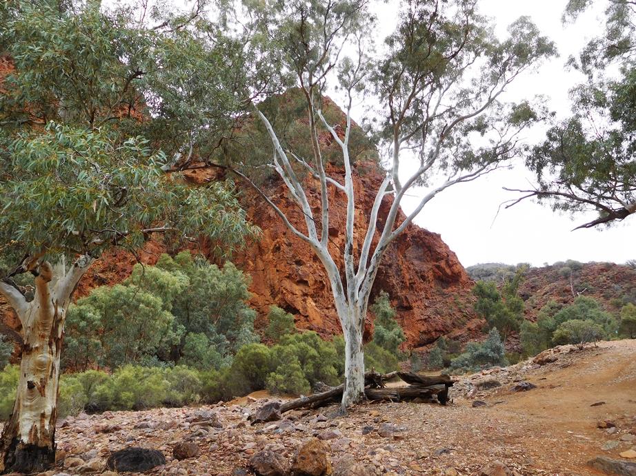
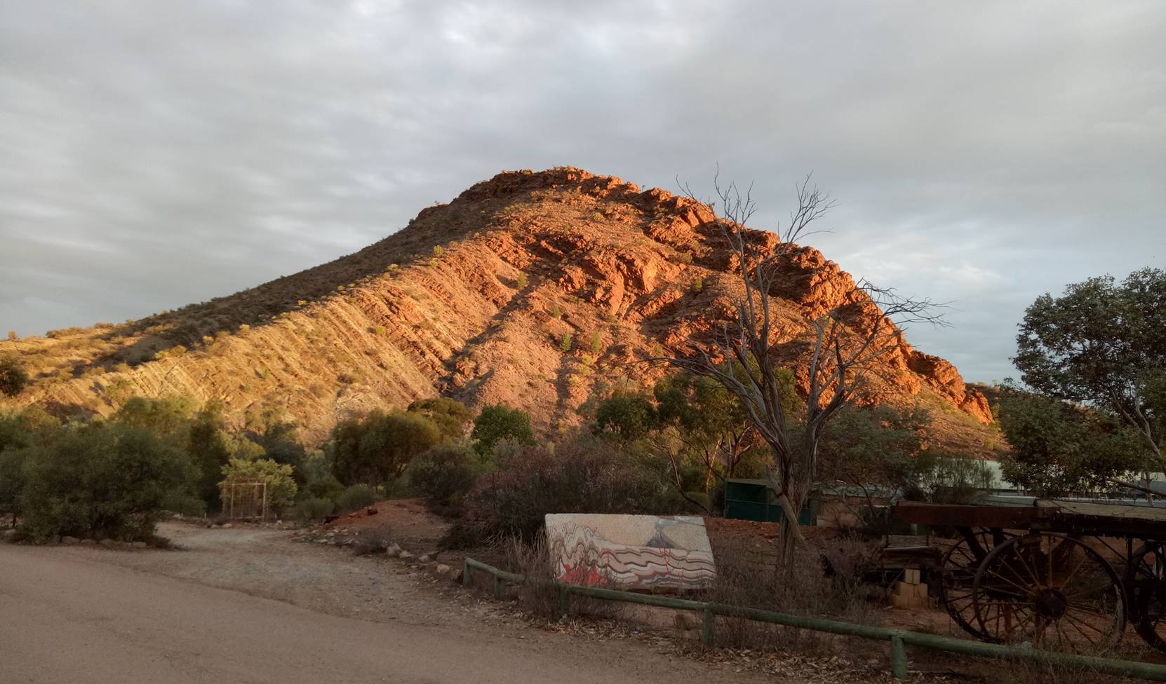
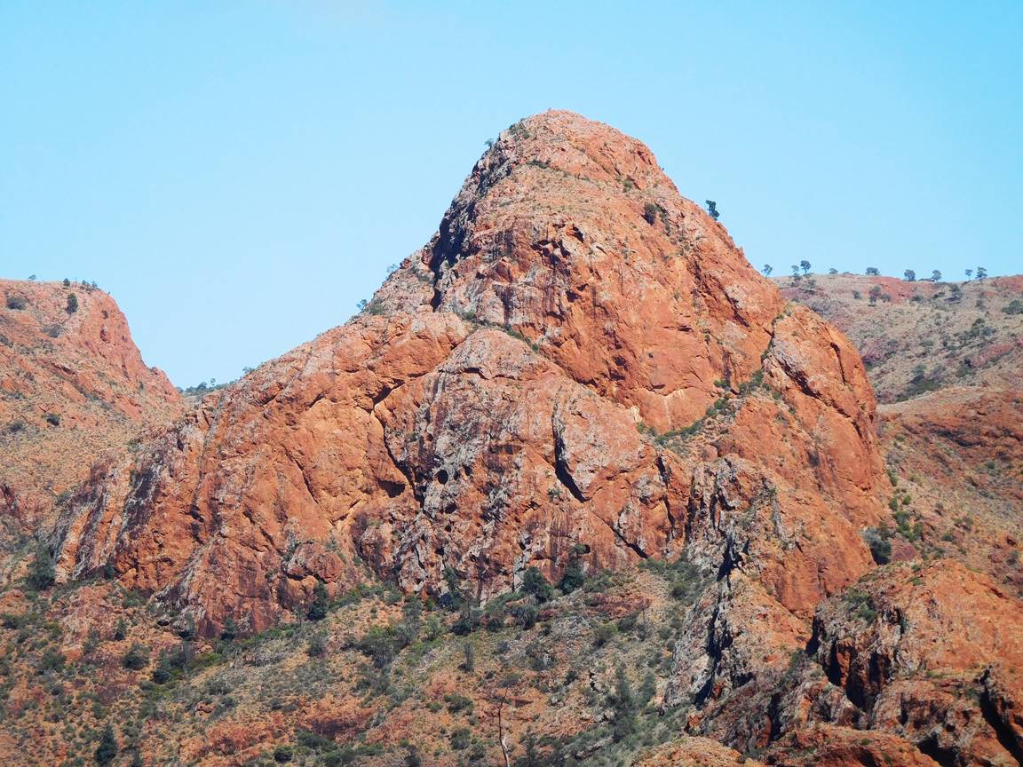
Arkaroola is a privately owned wildlife sanctuary covering 610 square kilometers of the northern Flinders Ranges. It was originally an unproductive pastoral lease bought in 1968 by geologist Reg Sprigg who began its conversion into what is now a centre of eco-tourism. Reg Sprigg has another claim to fame; in 1946 he discovered the first pre Cambrian fossils of animals dating from around 600 million years ago. These early animals are now called Ediacara fauna after the Ediacara hills on the western side of the Flinders Ranges where Reg made his discovery. The sanctuary is now run by Reg’s son Doug, who I’d say takes after his old man in many ways, in his love for the country, his exhaustive knowledge of the geology of the land as well as the flora and fauna. Doug’s enthusiasm is quite contagious and found myself trying to identify types of plants and gazing in new wonder at the spectacular rock formations, and if you want to see rocks, the Flinders Ranges is a geological wonderland.
The village has accommodation ranging from powered and un-powered camp sites to very comfortable motel-style rooms with a couple of steps between. There is a visitor’s centre with bar and restaurant, a good sized swimming pool, a small shop with a few essentials, fuel pumps and most importantly, a couple of public phones; there is no mobile reception in the area. There is (paid) wifi which only covers the area around the visitor’s centre, making it a good excuse to visit the bar. For the official Arkaroola web site go to https://www.arkaroola.com.au/
Our visit – Tuesday
We dropped our bags at our very comfortable motel rooms and went straight to the visitor’s centre so that Ricky could interview Doug for his article and it was soon obvious that he has a very wide-ranging interest and knowledge of scientific matters, the ability to remember the correct names for things and the sense of humour to pretend he just made things up. Now you could argue that remembering names of things is just rote learning but it’s a talent that I don’t possess.
A digression – just to show how bad I am at remembering things: Our discussion with Doug ranged a fair way and we were talking about the different types of ionizing radiation, as you do, including alpha, beta and gamma, and Doug mentioned that alpha radiation was pretty easy to stop, and I think I said something like “Oh yeah, it’s just electrons”. Doug was too polite to point out to me that I had mixed them up and that beta radiation was “just electrons”, but here’s the thing; I used to teach this stuff but couldn’t remember a basic fact. We got onto this subject because Arkaroola has been mined for both radium and uranium in the past. Radium was found there very soon after the Curies discovered its existence. It was very valuable because a neat use had been found; painting watch dials so they could be read in the dark. The glowing numbers on the dial emitted mostly alpha particles which were easily stopped, so safe for the user, but the dials were hand-painted, mostly by young women using fine brushes which they would lick to keep the point fine, they were actually taught to do this, thus ingesting tiny amounts of the radioactive paint. Those alpha particles the paint emitted changed the dna of cells causing cancer, deterioration of bones and in many cases, death. Doug also mentioned that in the north of Arkaroola were hot springs which had been touted at various times, early in the 20th century and also in 1947, as being ideal for the development of a health spa. The only problem is that the water is heated by the underground decay of uranium so the water is radioactive. Now all you folk who grumble about us living in a “nanny state” might consider that a bit of protection is not necessarily a bad thing.
We still had a bit of time before beer o’clock so decided to take in one of the many walks in the area, the Mawson Valley trail. The shop sells detailed survey maps but the trails are all well marked and we were in no danger of becoming lost. We only went as far as a large rock formation called “Sitting Bull” but it was a good warm-up for the next day. We retired to the restaurant where we ate a hearty pub-style meal washed down with a nice South Australian shiraz.
Wednesday
Next morning we borrowed a car to get to the start of the Bararranna Gorge walking trail. The weather looked threatening so Ricky took his super fancy rain jacket but my own rain jacket was safely stored away in a cupboard at home so I bought an emergency $5 rain poncho from the little shop. I have seen people wearing these things in the past and wondered why they were wearing large plastic bags and now I know. Within 10 minutes of starting the walk the wind came up and the rain came down and I spent the next hour looking like a large piece of litter. The walk was a 6.8 km loop, but we extended that by a few kilometers to visit the large water hole in the Bararranna Gorge.

As you might gather from the photos it involved a fair bit of clambering over rocks but I found it interesting and satisfying. We saw quite a few birds and animals, including 5 of the beautiful Yellow-Footed Rock Wallabies. In the afternoon I settled in the restaurant area and caught up with emails, while Ricky, being somewhat more adventurous and lots younger clambered up Griselda hill, the steep hill that overlooks the village.
Thursday – This was really action packed.
At 8:00 AM we met Steve, our driver and guide for the Ridge-Top Tour. This was a great way to see this part of the Flinders and I’d have to say that some of Doug’s enthusiasm has rubbed off on his staff. Steve was a cheerful, well-informed guide and mercifully a careful driver on the precarious tracks.
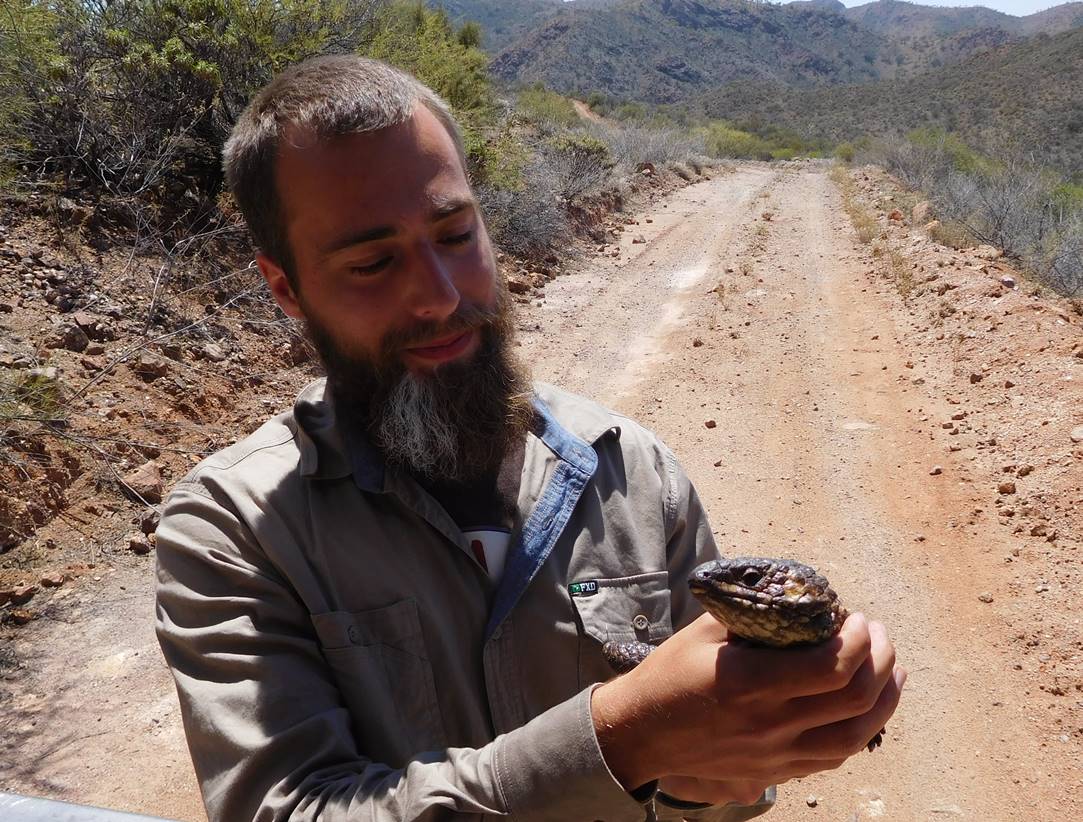
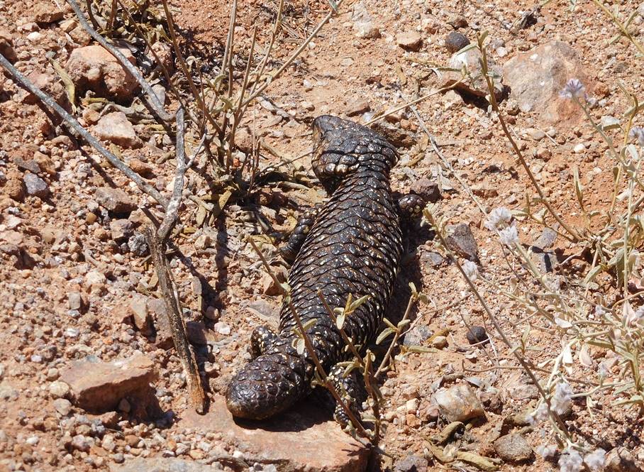
The shingleback lizard has an unusual defence – it looks pretty much the same at either end so predators aren’t sure which end to attack.
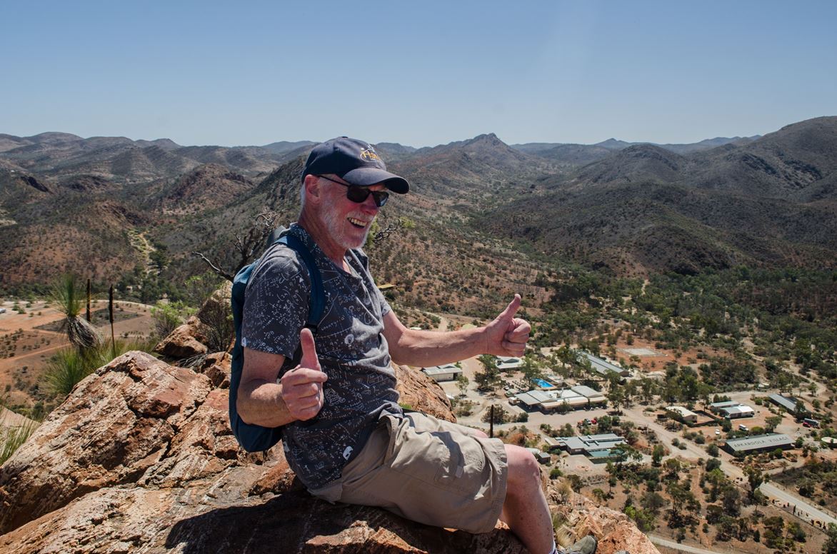
Early in the afternoon Ricky convinced me to attempt the Griselda hill climb. I currently suffer from sciatica and recurring bouts of bronchitis so I’m not the fittest of fellas around but as you can see, I made it.
At 3:30 we met Doug for a long flight in his Cessna 206. This took in Lake Frome as well as a large part of the Arkaroola area.
If you flew in as we did you could probably take Doug’s shorter tour, but as always, Doug was a mine of information.
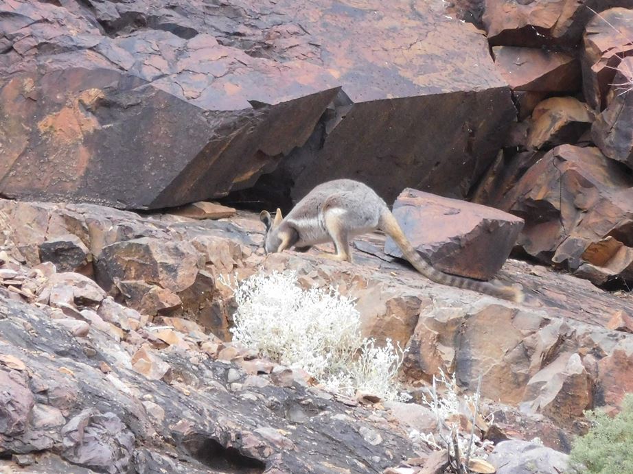
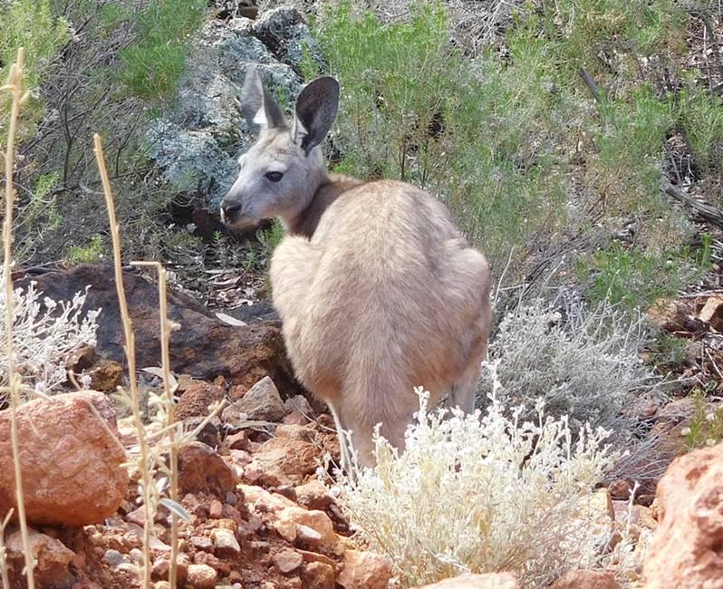
After the flight Doug was keen for us to see more of the iconic Rock Wallabies so lent us a car and pointed us in the right direction. I think Doug is really in thrall of these beautiful animals. I can understand that. At one time they were so scarce that Arkaroola held half of the known population. His information was good and during a short late-afternoon drive we saw more than 20 as well as a half dozen Euros.
After dinner we met at the mini-bus for the Observatory Tour. There are four astronomical observatories in and around Arkaroola. Again, Doug was the informative guide. This was interesting but would have been far better with a smaller group. We were in a fairly large group so had very limited time to peer through the lens. On the other hand, it was the first time that I have seen a globular cluster, a relatively tightly packed group of hundreds of thousands of stars. Apparently there are more than 150 globular clusters in our own Milky Way. I really have trouble getting my head around those sorts of numbers.
In the morning, Doug gave us a lift to the airfield and we said our goodbyes. Would I go back as a proper paying customer? I would love to. The whole Flinders Ranges are very arid and extremely rugged, but also quite beautiful.
A bonus for anyone flying into Arkaroola: there are cars available for loan, well a sort of loan; you pay $50 per day as a donation (to the Flying Doctor if my recollection is correct) and fuel cost. It’s a good deal.
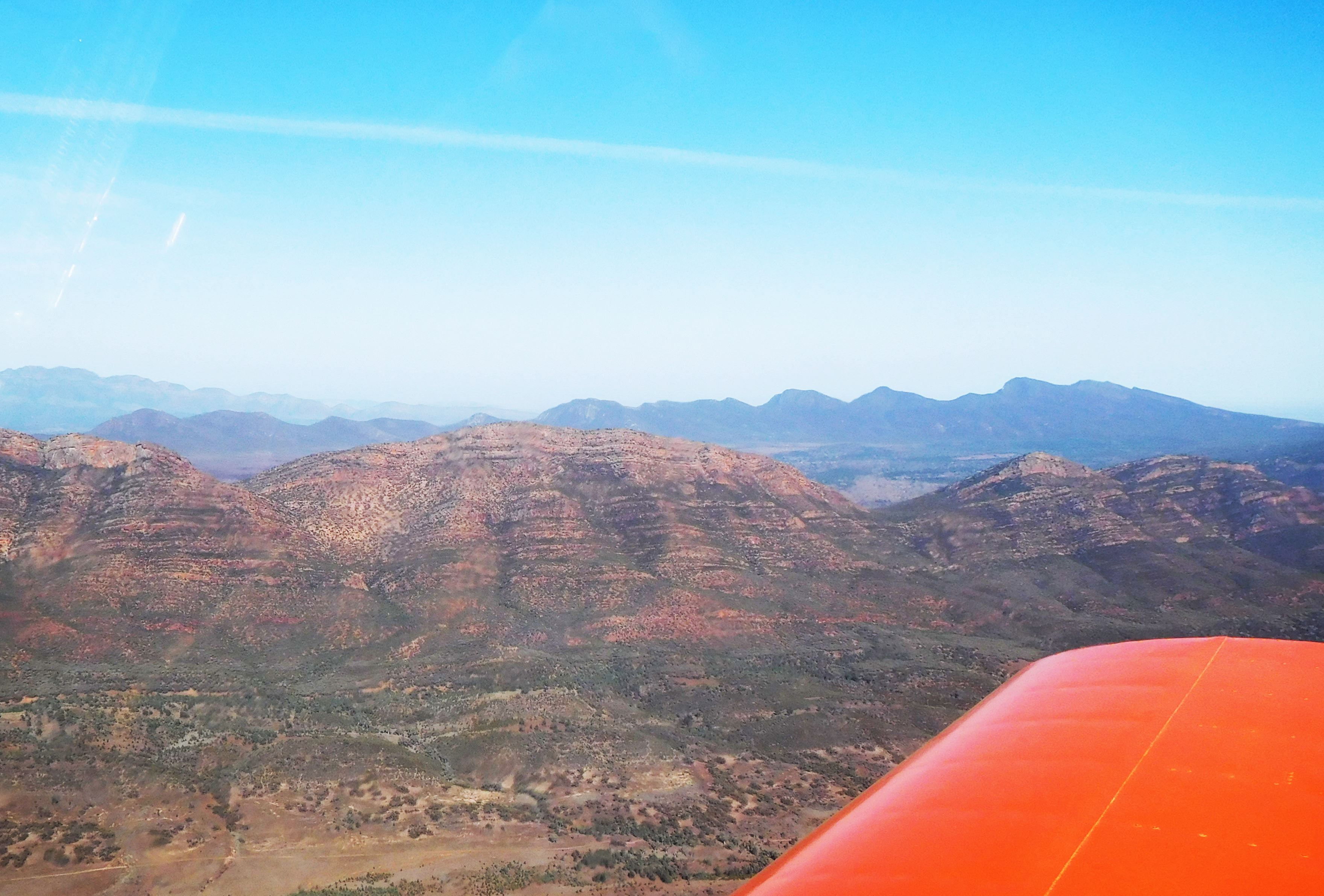
Arkaroola to Port Pirie – 183 NM
We climbed to 4500 on a heading of 199° which would take us roughly along the eastern side of the range to Rawnsley Park, near Wilpena Pound, and then head directly to Port Pirie. We were pushing a headwind, again, and my “auto pilot” took over until we neared Wilpena Pound when he wanted to take some photographs. 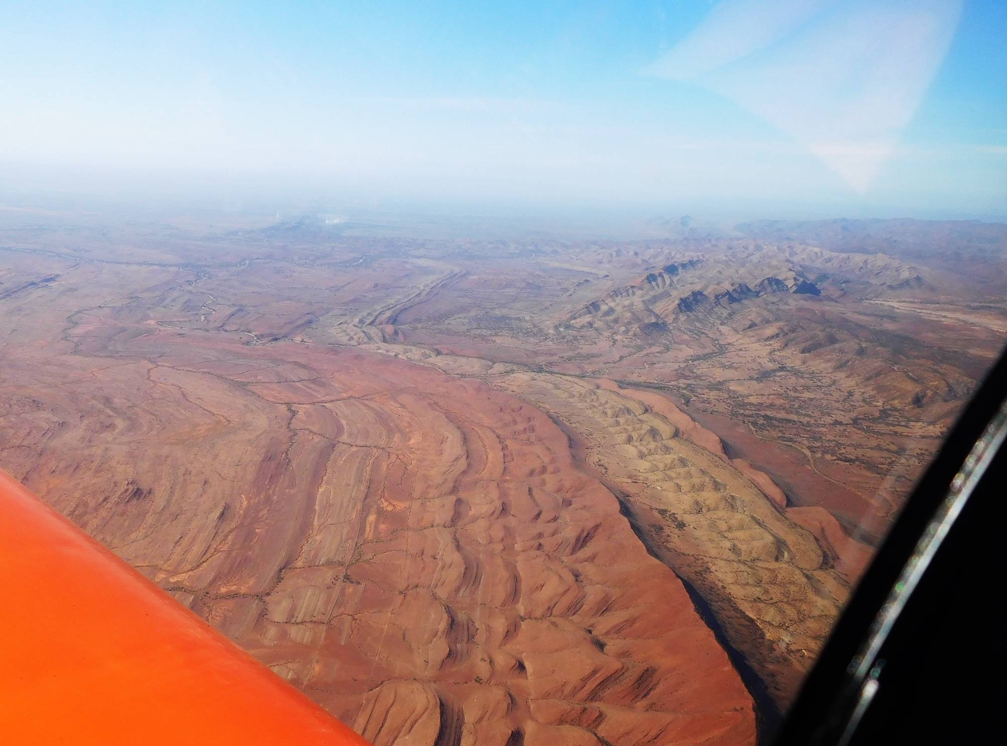
There were several aircraft operating joy flights from Rawnsley Park, with good reason, the view is spectacular.
The rest of the flight to Port Pirie was uneventful and there was a gradual greening of the country as we flew further south. 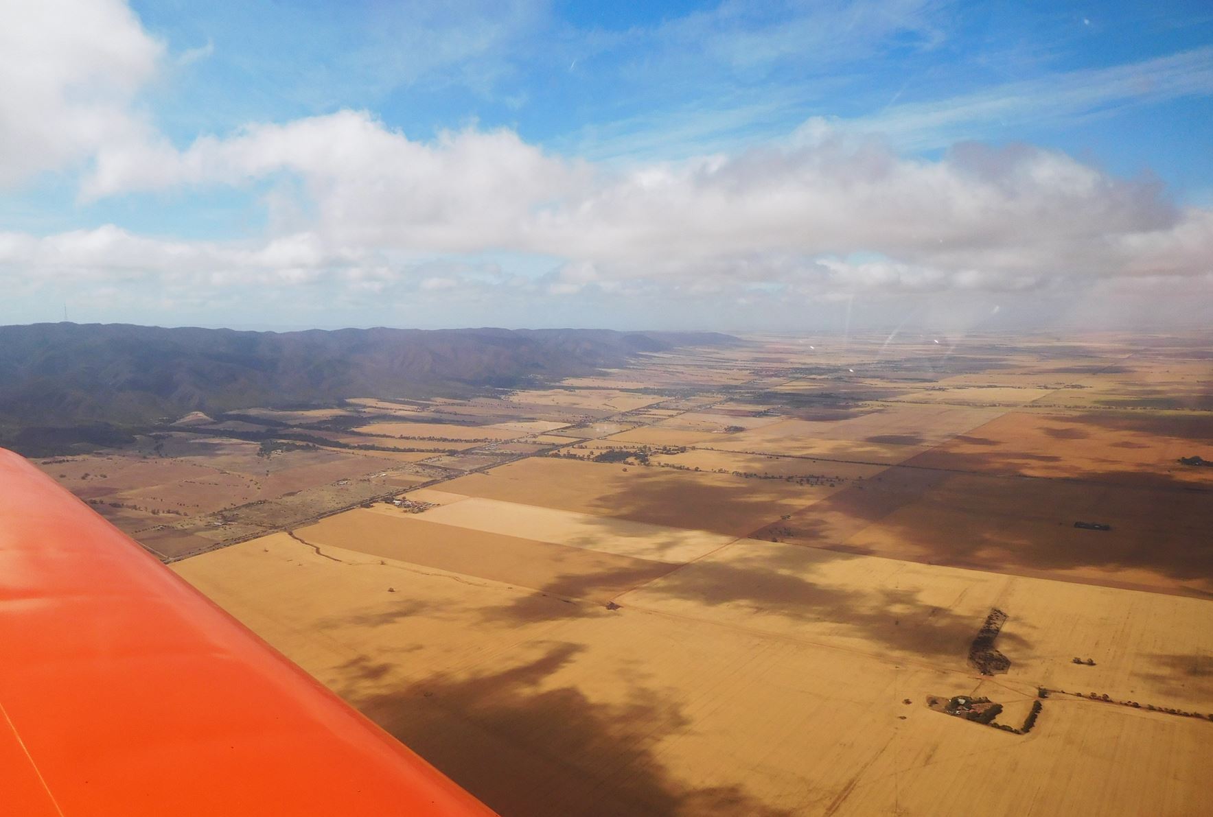 I was so busy scanning for the unfamiliar airfield that I didn’t even notice the port itself until I saw one of Ricky’s photographs. The port is about 5 km up a tidal creek, and was originally the port for Broken Hill, 350 km away. It now houses an enormous lead smelter so you can guess what one of the chief concerns in the area is. For some mad reason I decided to experiment with a full flap landing rather than my normal 20° of flap. The fairly heavily loaded Sonex dropped like a stone for the last few feet. I’ll keep my experimenting to myself in the future. I had read lots of favourable comments about Port Pirie airfield in the public comments on OzRunways and they are all true. The airfield manager gave us a very friendly greeting and even the fuel was the cheapest on the trip. If you are flying in the vicinity I recommend a stop there.
Time: 1.65 hours Av speed: 111 knots
Fuel used: 36.74 litres Price: A$2.08/litre
Port Pirie to Mildura – 219 NM
We set off on a heading of 111° for Waikerie on the Murray River, initially bouncing around under scattered cloud, but it looked like there were plenty of gaps so climbed to 7500 ft and for the only time on the whole trip achieved a cruise speed of 130 knots. At one time it even went up to 140 knots until I noticed that the higher speed was accompanied by a slightly different vibration, 30 litres per hour fuel consumption and 3000 rpm. The throttle friction had slipped slightly. A couple of years ago I flew a course only a little to the north and thought I was flying in a very remote area, but after what we had been flying over this felt highly populated. For one thing, we could always see a road somewhere. Not long after a course change at Waikerie the cloud closed up and we were forced to do a spiralling descent through a large hole. From there to Mildura was rough and tedious, with the only benefit being that I saved a bit of fuel with the power backed off.
Time: 1.90 hours Av speed: 115 knots
Fuel used: 36.24 litres Price: A$2.313/litre
Mildura to Kyneton – 213 NM
We were back-tracking runway 18 when I noticed an increase in noise and drag. Damn, a flat tyre. It could have been worse; it could have gone flat after take-off and been a nasty surprise when landing. I made a radio call to warn other aircraft that we were blocking the runway and received an immediate response “I’ll be right there”. By the time we had unbuckled and got out to inspect the damage, the tyre was so flat it wasn’t even seated on the rim, the airport safety/security guy had arrived in his ute. His only help was to offer to get us a mechanic, “Nah, we’ll be right”, then as we dragged the Sonex clear of the runway he pointed out that we needed to be past the outer white markers, about far enough to clear the way for any stray A380s. He then kept watch over us while I jacked the Sonex removed the wheel and fitted a spare tube.
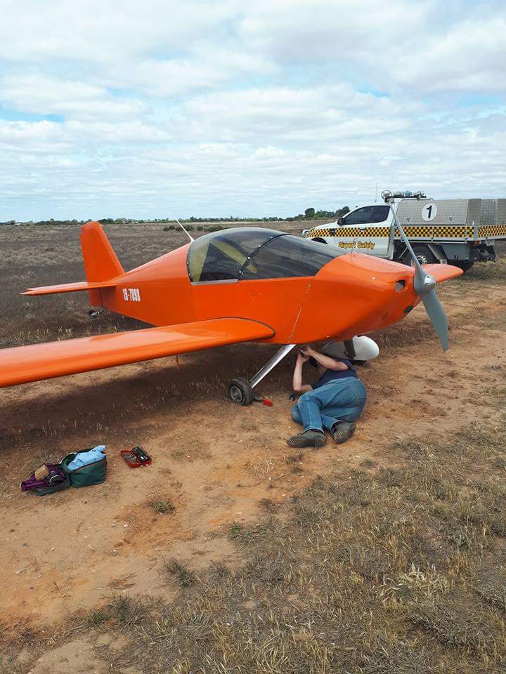
Now I’m not keen to go on setting an example to you all, but if you don’t already own one of my quick lift jacks, you should. When I had finally finished he asked to see my ASIC (Airport Security Identification Card), presumably because having fixed my flat I was back in terrorist mode. I tossed him my card and while I was packing he filled out his “justifying my job” book. I suppose I shouldn’t be too grumpy about this because in the past 5 years I have spent over $600 maintaining this idiotic ID card and it’s the first time anyone has asked to see it, and I had to get a flat tyre at a security controlled airport to prompt even that. Nevertheless, I think he has earned my limerick for this trip (to be read with increasing rage).
The security guy from Mildura
Performed his job with some bravura
“I’ll command all this field
With the POWER I wield
And demand all their ASICs mein Fuhrer”
By the time we had fixed the flat the cloud cover was complete so we did this leg at 3000 to 3500 feet and while our nominal course was 139°, we wandered well off course avoiding the odd rain squall and anything that I thought might cause turbulence. Interestingly, Ricky seemed to be able to get more reliable rain radar on his mobile phone than I could get with my iPad and OzRunways. He announced that it was raining at Castlemaine, a little to the west of our intended track with the prevailing wind pushing the rain across our path. By the time we were adjacent Bendigo, which was clear, Mount Macedon was still hidden in the gloom so an approach to Kyneton was looking unlikely. I think Ricky was getting a bit nervous at this stage but Castlemaine was now visible and the weather coming from the south west looked reasonably clear so we headed for Castlemaine. There is a small airfield at Guildford, just to the south, where we could put down in an emergency. As we were overflying Castlemaine we had a bit of luck in the form of a circuit call from Kyneton so were able to find that the circuit area was clear, and after tracking a bit further south we could see the way home. It was a fairly stressful last leg to the trip.
Time: 1.92 hours Av speed: 111 knots
Fuel used: 36.96 litres Price: A$2.21/litre
Summary for the whole trip
Distance: 1124 nautical miles
Time: 10.10 hours
Fuel: 201.54 litres
Av. speed: 112.3 knots 129.2 mph 208 kph
Av. fuel 19.95 litres/hr 5.27 US Gal/hr