But first a few ill-informed impressions of Rockhampton – For us Victorians, the best time of the year to visit is winter. In summer I find the heat oppressive. It really is just acclimatization. I have seen my relatives from the north shivering on beautiful sunny days in Victoria. Rocky used to be all about beef cattle, and you can still see freight train loads of cattle going down one of the main roads, (That’s right, the train line runs down the middle of the road) but it is also associated with mining. The recent downturn in coal mining has hit it pretty hard, illustrated by the fact that at one of local shopping centres, many of the shops were closing down. The area is prone to fairly extravagant weather, frequent flooding, impressive thunder storms (not much snow though) and the area was severely damaged by a cyclone early last year. Power was out for over two weeks and some of the damage is still being repaired 18 months later, but that’s what you have to put up with when you don’t live in a sensible place like Victoria. At a family level, as well as my mother and sister, Jennifer, I have a niece and her two sons living there. That makes me a GREAT uncle. Jen likes to support her grandkids in all their sporting and artistic endeavors so during the course of my visit we managed to take in a school rugby game, a game of under 14 Australian Rules football and a game of under 11 soccer, all thoroughly enjoyed. I hadn’t given them much notice that I was coming, in fact I phoned Jen from Roma the previous evening, and found they were booked to go to an opera on Saturday night. It was a travelling production of “The Barber of Seville” put on by Opera Queensland. I managed to get a ticket and it was a great show. I had Largo Factotum (Figaro, Figaro, Figaro) rattling around in my brain for the next two weeks at least.
I had picked my weather for the trip north pretty carefully but had more limited options for the trip home. It looked like Wednesday 10th of August was a reasonable option with a front coming through but ahead of a huge low. I had already been out to Hedlow to do a more thorough inspection of the Sonex and it was ready to go. Incidentally, while I was there a group of sky-divers walked past on their way to the jump aircraft, which I took to be a Cessna 172 with the door removed. It must have had a fair bit more removed because it took off carrying 5 jumpers plus the pilot, apparently hoping to make it to 8000 feet. We set the alarm for early and Jen had me at the airfield by 7AM. It was a beautiful clear day in Rockhampton but as we drove to the airfield we entered a thin layer of fog so had plenty of time to pack the aircraft, pay my rent and say goodbyes. I intended taking a different route out, still crossing the Fitzroy estuary, but tracking south for Gladstone, then my first fuel stop at Kingaroy followed by stops at Moree, Narromine, Narrandera and finally Kyneton. My aircraft is equipped with a PLB (personal locator beacon) but it’s not automatic, so for this first leg I removed the cover so that in any emergency I wouldn’t be fumbling. By the time I had warmed the engine I could see blue overhead, the sun through the mist and each end of the runway.
Hedlow to Kingaroy via Gladstone – 218 NM
It was about 8AM when I called SARTIME (my wife, Sue) and taxied to the end of runway 17. Visibility wasn’t quite as good as I thought. The far end of the runway had disappeared into the mist, but the glow of the sun was very clear and I did have nearly a kilometer visibility, so headed off into the wild grey yonder while keeping the sun firmly clamped in the corner of my eye to make sure I didn’t lose orientation. Nevertheless, it was certainly a relief when the Sonex burst through the top of the thin cloud layer. I did a twist and turn to take the following photographs and then headed for the coast.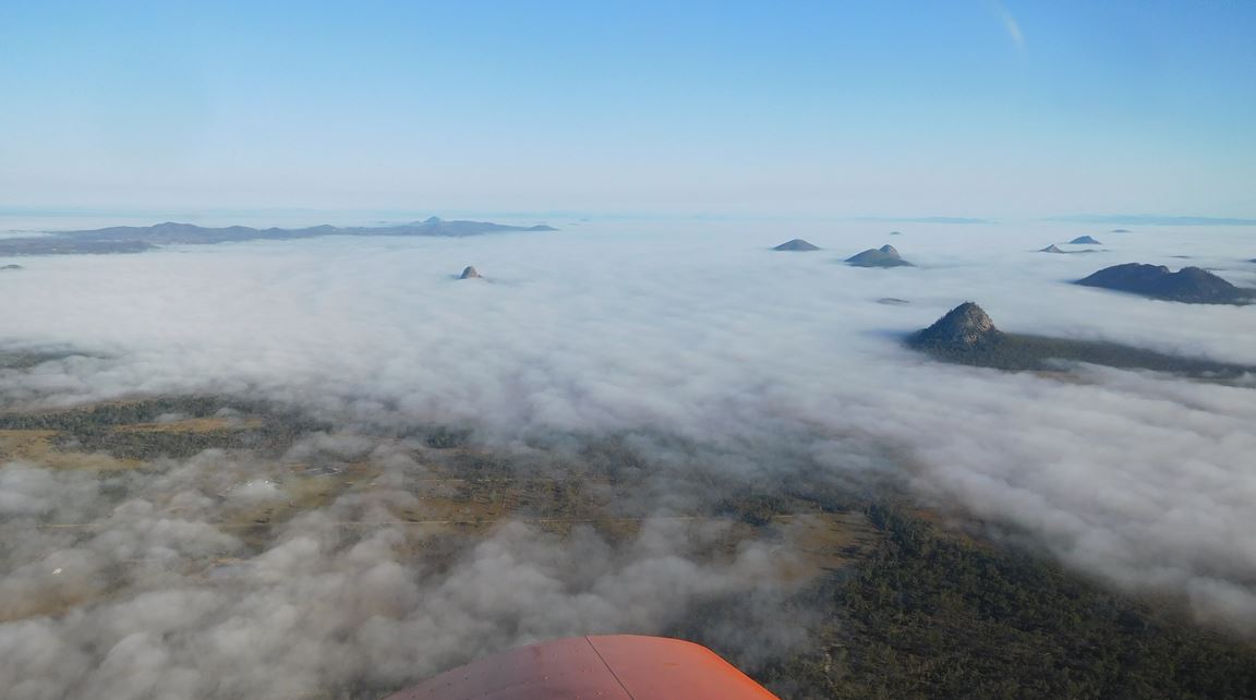
The rock poking out of the mist is mount Iron Pot and Hedlow is about the centre of the photograph.

Hedlow airfield is roughly halfway between Rockhampton and the coast. There are several seaside towns along the coast with the largest being Yeppoon, which I mention just so I can justify the following artistic endeavour:
There was a young man from Yeppoon
Whose problem was coming too soon
So he tied a reef knot, In just the right spot
Now his scrotum looks like a balloon
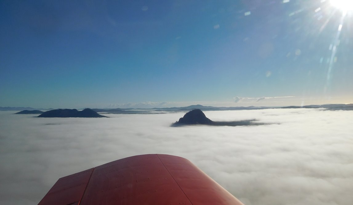

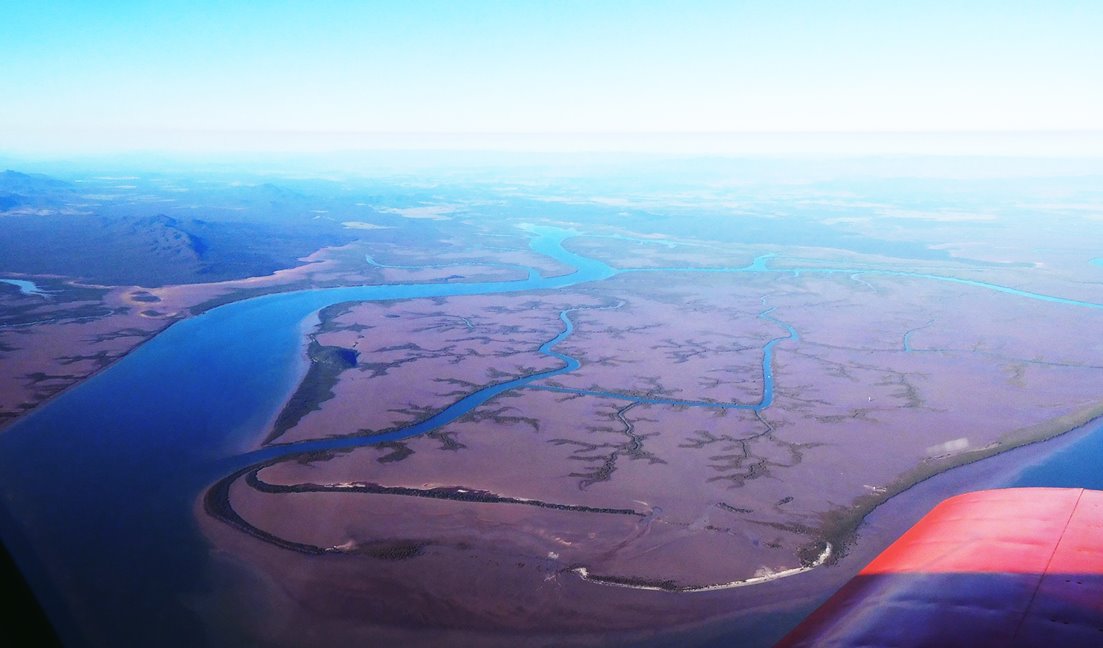
Above photos are Mt Jim Crow, Mount Archer (Rockhampton is just the other side) and more of the Fitzroy River estuary.
I followed roughly the same course as flying in, making my turn at Keppel Sands and following the coast to Cattle Point, but went a little further out to sea which kept me outside Rockhampton’s controlled airspace so I could climb to 5500 feet which would hopefully give me a few more options in an emergency, like will I crash-land into this mud or that mud. Flying conditions were just beautiful and the view was great, even if the landing areas were not. The track was roughly along the channel separating Curtis Island from the mainland.
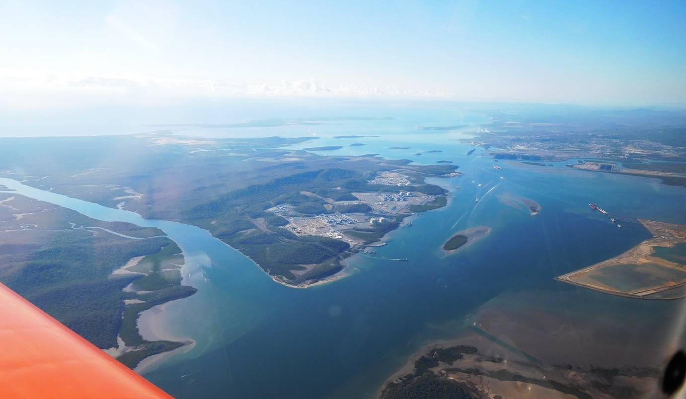 This is the Curtis Island gas liquefaction plant. The Bechtel web site claims that it employs 12,000 people although I suspect they are talking about the construction phase. It’s all part of the economic “trickle down” effect, sometimes better described as the “piss on” effect. In the background is Gladstone, with Gladstone airport, 30 NM from Cattle Point, the first viable landing place and my next waypoint.
 Curtis Harbour and Gladstone – the long jetty in the foreground is a coal export terminal. The one immediately behind it is another bigger coal export terminal and about 250 kilometers north near Mackay is another huge coal export terminal, all doing what we do best, digging it up and shipping it out.
 I had to look up what this huge orange area was and the answer is bauxite, feeding an alumina plant and another bulk export facility. (No it’s not. I have since been informed that it’s the tailings dam – the stuff that’s left over from the alumina process.)
I think the process goes roughly like this:
Hole in ground >>> bauxite >>>alumina >>> aluminium >>> >>>Al6061-T6 >>> Sonex.
Let’s all try not to complete that cycle with our Sonexes.
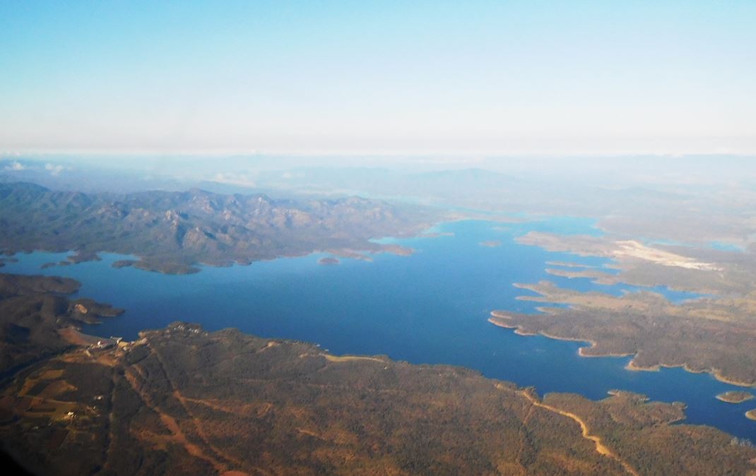 Just south of Gladstone is Lake Awoonga, a reservoir of course. It covers most of the old Glengarry pastoral station, and according to Wikipedia made Glengarry “unviable as a pastoral station.” Well, yes, I suppose it would. At this stage my course wandered around a fair bit is I procrastinated about which side of a mountain range to fly. I tried them both and neither option was great so I climbed to 7500, got back on track and the country gradually changed to open farmland. My first refueling stop was Kingaroy, centre of peanut growing in Australia. Even all the street signs used to be shaped like peanuts – might still be. Kingaroy is well known as the home of former Queensland Premier Joh Bjelke-Petersen, much loved by conservatives and much hated by everyone else. Rather than get political, I’ll relate my Kingaroy story.
Years ago, when I owned a small motorcycle shop, I didn’t have much time for holidays but would close the shop for the Christmas to New Year break and drive to Queensland to visit my parents, who lived at Childers near Bundaberg. We didn’t have much time and flying was expensive so as soon as we shut up shop, often about 4PM on Christmas eve, we’d bundle the kids into the car and head for Queensland, taking turns driving through the night. It was a pretty tough drive but usually completed in less than 24 hours. On one such trip, we stopped in Kingaroy at about 11 AM for a short break and an icecream and got talking to another young family who were doing a similar trip. “Gosh it’s a long way up here.” he said. “We’ve been driving for three days. When did you leave?” Our answer, “4:30 yesterday afternoon” absolutely floored him.
Fuel used – 41.5 litres
Kingaroy to Moree via Dalby – 205 NM
While I was refueling a young local wandered up for a chat. It turned out he had a Corby Starlet which he had just about finished re-covering, and had his own Cessna 188 crop sprayer and had just returned from flying Ag Tractors around Griffith. I mentioned him to one of the Corby flyers at Kyneton who said “Last I heard he was flying water bombers in Canada”. Those guys really get around in search of work. I really like the way so many professional pilots are also enthusiasts. At Kyneton quite a few private aircraft, often home-builts or vintage aircraft, are owned by airline pilots.
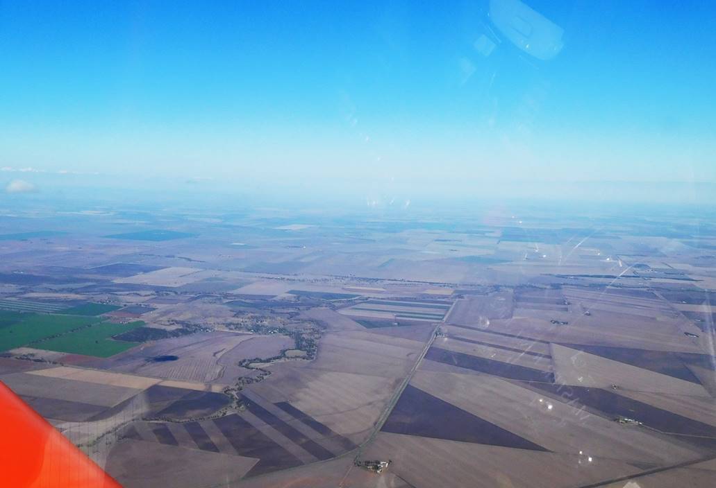 Not much I know about this part of the country except that there’s lots of it. The farms are huge. I tried a couple of different cruise altitudes but wasn’t able to gain any speed into a light headwind. I arrived at Moree after 104 minutes, read the wind sock badly and ended up doing almost a down wind, cross wind landing. Good thing the runways are big.
Fuel used – 34.3 litres
Moree to Narromine – 183 NM
There is more open farming country until a little after Wee Waa. Just a pause here to note that while peoples of other nations probably think they have a pretty good handle on silly place names such as Medicine Hat in Canada and Mouse Hole in England, I think that with names like Wee Waa, Woolloomooloo in Sydney and my favourite, Mount Buggery in Victoria, us Aussies are right up to the mark. With that in mind, I passed the Warrumbungles National Park, home to the Siding Springs astronomical observatory but my track was about 12 miles from the telescopes so there’s not too much to see in my photographs.
 As I approached Narromine I met a front coming the other way, a long line of cloud dropping a curtain of rain in the otherwise blue sky. I was able to go around the end of most of the rain and so approached Narromine from the east.
Fuel used – 30 litres
Narromine to Narrandera – 172 NM
I wasn’t watching the time too carefully because I knew I had plenty of time to reach Narrandera, but it was looking unlikely I would make it home in one day. It was after 3 PM when I departed Narromine, with sundown at 5:40 and over 350 NM to go. Looks like I shouldn’t have spent so much time chatting at Kingaroy. A headwind wasn’t helping. I tried 6500 ft, then 4500 ft and finally settled on 2500 ft. My ground speed was barely 120 knots.
 With all the rain we have received lately you’d expect the lakes to be full, right? This is Lake Coolah just north of Narrandera, and despite all the rain it’s less than half full.
Fuel used – 29.75 litres
Narrandera to Yarrawonga – 83 NM
This wasn’t my original plan. By the time I had refueled there was only 45 minutes to sunset but I was reluctant to stop. I checked the distance and time to Yarrawonga and it was doable, just. There were other reasons to try for Yarrawonga. I knew where I could get good accommodation, I was familiar with the town and I had originally considered going that way so I could buy a case of oil from the shop at Yarrawonga Flight Training. What the hell. I took off without delay and didn’t bother going above 2500 feet. After only 10 minutes I was having misgivings. The time to destination numbers on the iPad were OK and speed was up but the sun was sinking and many of the fields were flooded. If there was any fog at Yarrawonga the nearest alternative airfield is Corowa, 16 NM east and also on the river. If I had to do an out-landing it was going to be into a very wet field. I gradually pushed the speed up so that I did much of this leg at over 140 knots. I was mighty relieved when Lake Mulwala came into view, and had an undeserved bonus when I made my circuit joining call. Peter McLean from Yarrawonga Flight Training called me back to offer hangar space overnight. I made my last call of the day to Sue as I taxied in and we put the Sonex to bed for the night. Now just in case you think that I did something stupid and it could have ended badly, I can only argue that I did something stupid and it could have ended badly.
Yarrawonga to Kyneton – 110 NM
There was no hurry in the morning as the town was covered in low cloud, but a taxi had me back at the airfield by 8:30. There was plenty of time to pack, do the daily and drink several cups of tea while waiting for the cloud to break up. Peter was happy to chat and had an interesting flying history. He started in the air force training on Winjeels before flying various jets from that time but ended up going on to helicopters and flew Hueys in Vietnam. He later transferred to the navy and flew Skyhawks off HMAS Melbourne. (Just to wander a bit further from the centre of the story, HMAS Melbourne has the unusual distinction of sinking two ships during peacetime, unfortunately its own escorts: HMAS Voyager in 1964 with the loss of 82 lives and the USS Frank E. Evans in 1969 with the loss of 74 lives.) Peter now teaches students to fly microlights, or trikes as we call them. He must be doing a good job because Yarrawonga is home to around 30 of them. Certainly the welcome is always very friendly, for example the offer of overnight hangar space.
 By 10 AM I was on my way and flying above low scattered cloud.
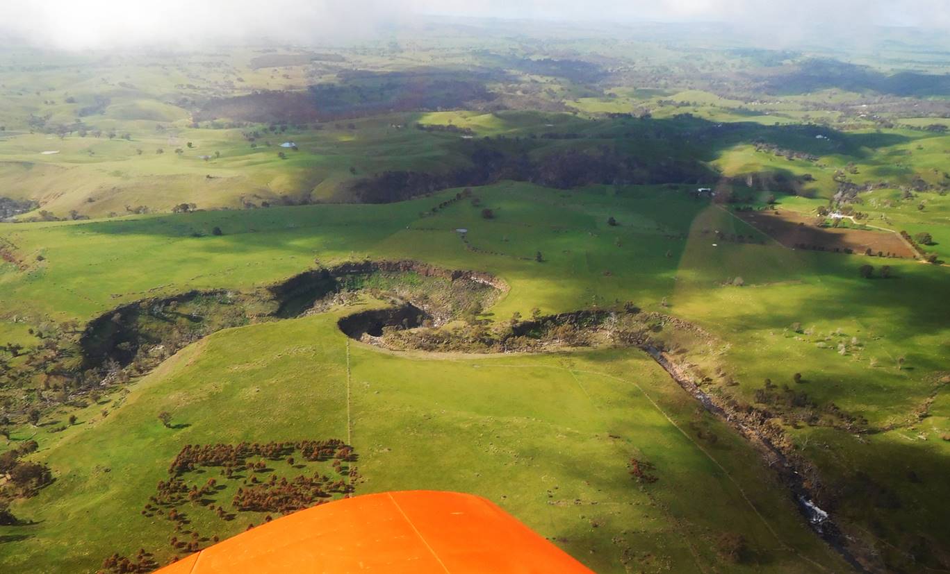 Getting close to Kyneton – an erosion gulley formed by the Campaspe River
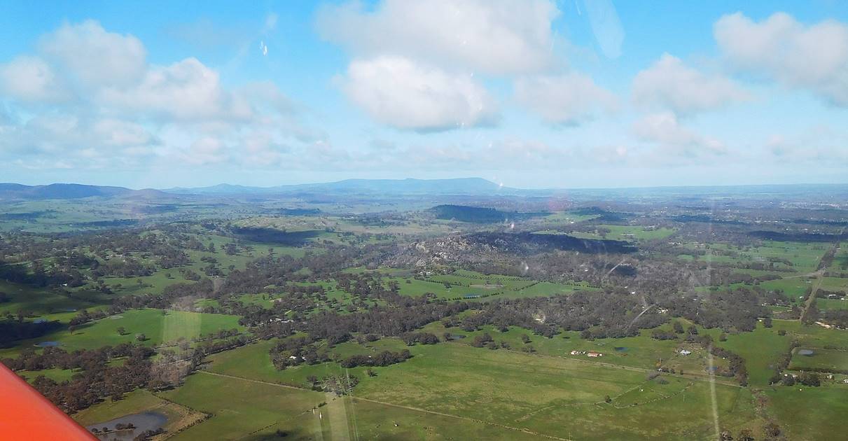 Kyneton in sight, just visible in the distance at the far right of the picture. Home for me is visible too. The low hill on the centre horizon is Mount Macedon. It doesn’t look much in the photo but is over 3000 ft.
Fuel used (Narrandera to Kyneton) – 37.5 litres
Total distance: 971 nautical miles
Fuel used: 173 litres
Flying time: 8.88 hours
Av. speed: 109 knots
Av fuel: 19.5 l/hr
Averages for whole trip
Distance: 1901 nautical miles, Fuel: 320 litres, Time:17.02 hours
18.82 litres/hour 111.7 knots
Things I learned about the Sonex and myself
- I found that the Sonex is very capable of long distance touring, and even for two people of average size it would be OK. I was carrying a tent, sleeping bag and sleeping mat plus 10 litres of fuel “just in case” but in truth I was never going to need the camping gear, and one more fuel stop would have eliminated the need for the fuel. Without that bulk I could easily have fitted another person’s luggage. A proviso here is that I only weigh 70 kg so I fit into small aircraft easily. I have carried passengers of up to 110 kg and really, they are too big for the Sonex and would severely limit the luggage load.
- The seats are not good enough for a really long haul. I found this out the first time I flew for more than a couple of hours in one day. Since then I have been using a cheap but very lightweight lumbar support, and it has been OK, but it was not good enough for a day of flying. I felt fine at the end of the day but my back was sore later. I’m going to try copying the shape of my car seat back in styrene foam, with an allowance for seat-back sag, and then fitting that behind the existing seat cushion.
- When you are doing distances of up to 280 nautical miles between stops it is easy to become blasé about the distances covered. I think that is why I thought so little about setting off on a 83 NM trip with only 45 minutes to sunset, something I wouldn’t normally do. The idiot box said I could make it but there was no Plan B.
- Extra info: On the Moree to Narromine leg of the trip, I mentioned odd place names, completely missing the fact that I had passed within 14 NM of Gulargumbone. I always thought this was a fake name like Waikikamukau in New Zealand. My apologies to the good folk of Gulargumbone.
Epilogue
While I really enjoyed the flight, Sue was definitely not in favour of me doing this trip. I think the word “madness” might have crept into the conversation, however she did email a cartoon with the caption “Love is telling someone to go to hell and then worrying whether they’ll get there safely”.