Click on images to enlarge
My sister has lived for some years in Rockhampton on the central Queensland coast, and after the death of my father a few years ago my mother was persuaded to move in with her. Meanwhile, I live way down south at Mount Macedon in central Victoria. For years I have been flying to Queensland 2 or 3 times a year to visit family, but always by airliner. It seemed like a good opportunity to try my Sonex on a longer trip, but it took a bit of planning. The distance is over 900 nautical miles and useful refueling stops are well spaced out; the Sonex has limited range; it required crossing the Great Dividing Range which is not high but is very wide in this part of Queensland; and my RAA permit doesn’t permit me to fly into Rockhampton which is in controlled airspace. The last problem was solved by flying into Hedlow, a small private airstrip to the east of Rockhampton, but this brought an additional problem. The shortest way into Hedlow required flying below controlled airspace over the estuary of the Fitzroy River. Now in Australia, the common name for land on which it is not possible to make an out-landing is “tiger country”, but the Fitzroy River estuary looks like “crocodile country”, and it’s no coincidence that saltwater crocodiles are also known as estuarine crocodiles. These are the biggest reptiles on the planet and they can swim faster in water than I can run on land, but the estuary doesn’t really have any land, just mud flats. The sound of a forced landing would be SPLOOK. As it turned out, there has been so much rain lately that this wasn’t the only patch of mud I would cross, but it was definitely the bit with the biggest teeth.
Kyneton to Griffith – 195 NM
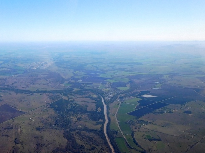
I had hoped for an early start but eventually didn’t get away until 9:30. All the country is open farmland, just a bit greener and wetter than normal. 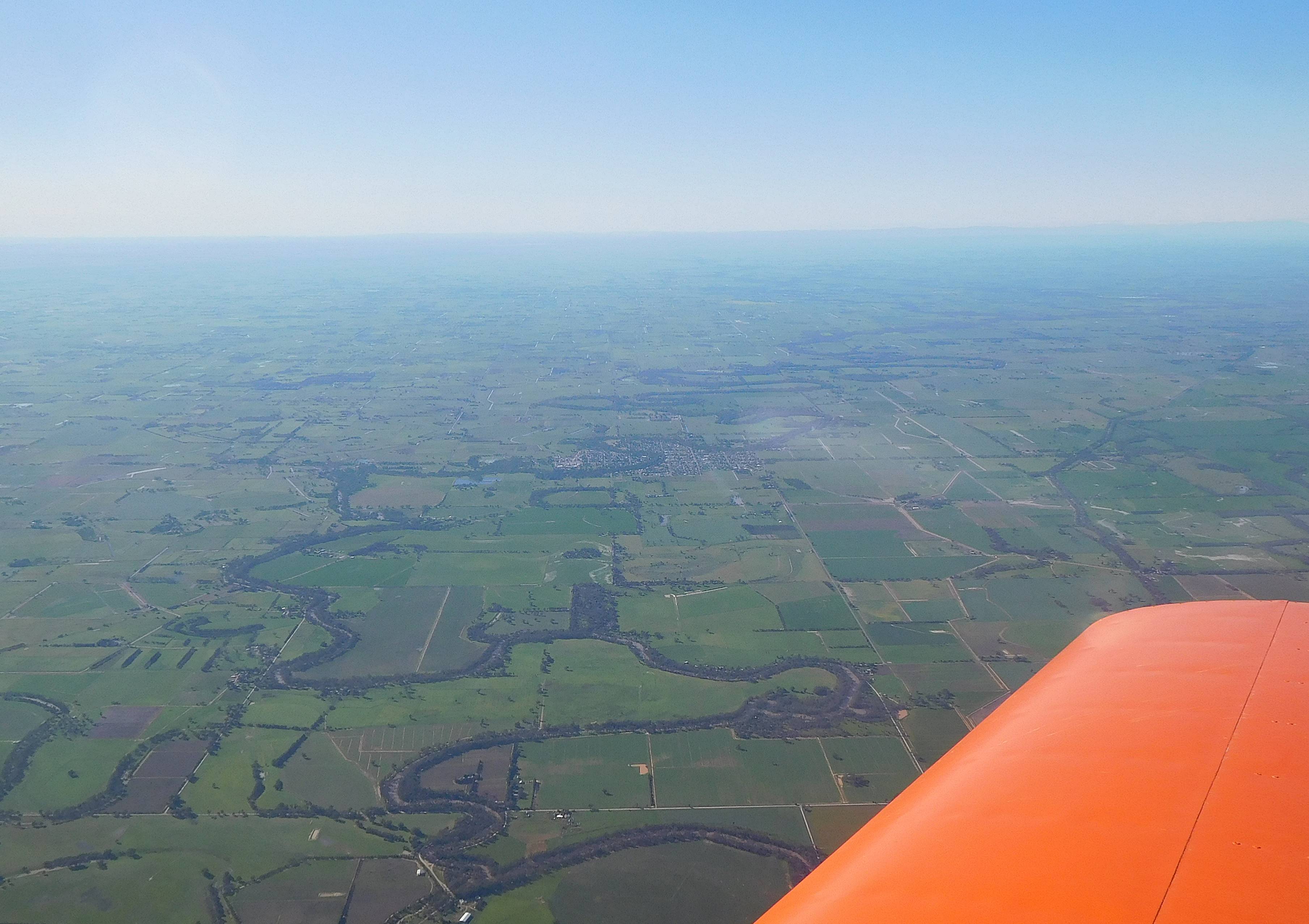 The little town in the centre of the photograph is Nathalia, taken for no other reason than it gives me a chance to recycle an old limerick.
There was an old man from Nathalia
Who painted his arse like a dahlia
The colour it’s true, was just the right hue
But the scent, alas was a failure
 Just a little further on is the Murray River, border between Victoria and New South Wales, and after around 95 minutes of uneventful flight I was over Griffith. The airfield was pretty busy with crop sprayers servicing the local farms and had enough nooks and crannies that I had difficulty finding the fuel bowser. Fuel used, 32.1 litres. I made sure the tank was really full because the next leg of the journey was 279 NM which is a bit of a stretch.
Griffith to Walgett via Condobolin and Warren – 279 NM
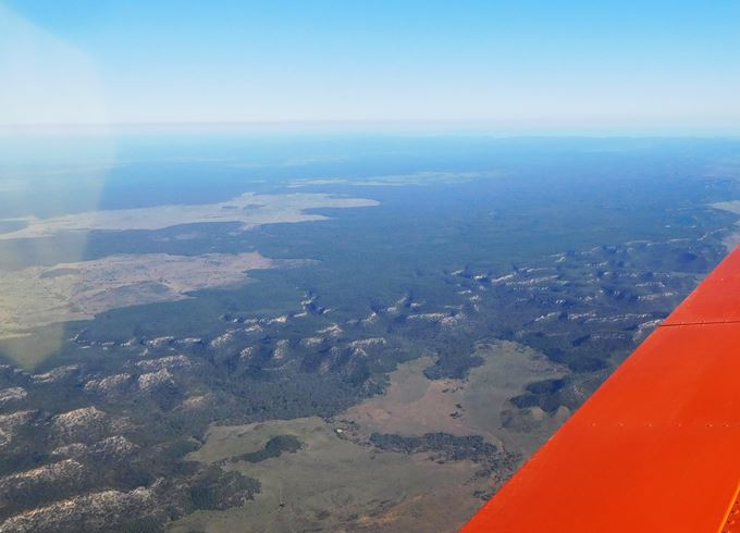
The country on this part of the journey is largely open farmland with small towns becoming so scattered that the air navigation maps show locations of every cattle station (ranch).  About halfway to Condobolin was this abandoned mine, and haven’t they left it looking good? From Griffith to Warren my cruise altitude was 7500 feet and I wasn’t getting too much wind assistance so I was keeping a very careful eye on fuel remaining and fuel flow rate, but at Warren I turned a small corner, climbed to 8500 and gained an increased ground speed. My “Plan B” was to divert to Coonamble to top up with fuel, but the higher speed allowed me to reach Walgett with 17 litres remaining. The country around Walgett was pretty waterlogged and the airfield still had big puddles on the tarmac. As one of the locals said, “We’ve had seven years of drought and now it’s all come at once”. My total knowledge of Walgett is from a poem by Banjo Patterson called “Been There Before”, the gist of which is that some locals in a pub bet a stranger that he can’t throw a stone across the Darling River. The trick is that there are no stones within 50 miles, but he wins the bet by taking a stone from his pocket. He had “been there before”. I asked a lady from the aero club if the legend was true and she said “Not any more. Gravel has been trucked in for road making”. Fuel used, 43 litres.
Walgett to Roma via St. George – 212 NM
The country out this way is hardly featureless but there is not a lot of variation. In my home state of Victoria you are always within 20 or 30 miles of a town and there is the occasional lake or mountain range, so identification of landmarks is fairly straightforward, but this part of the country is flat with numerous small winding creeks and rivers which all tend to look the same. From Walgett to St George is over 120 NM with just one small town about 10 miles to the west of my route and a tiny village about 18 miles off to the east. All you can really do if the ipad carks it is try to hold your course accurately and run the clock. At least when you do come to a town you know exactly where you are because there isn’t another one within 100 miles.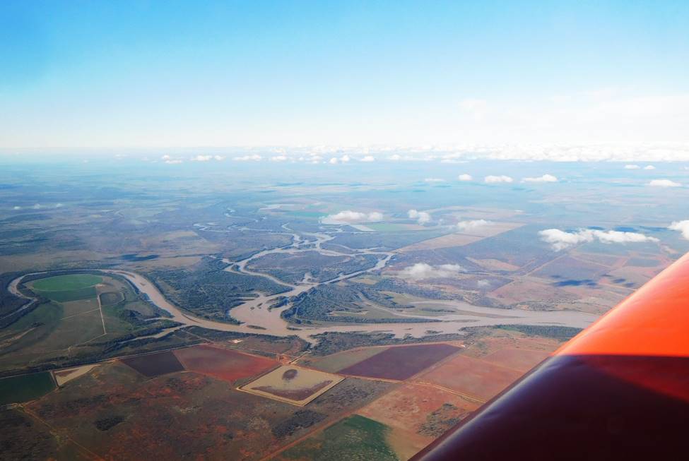 Just north of St. George is Lake Kajarabie, really just a wide section of the Balonne River.
I was making pretty good speed on this leg, flying at 8500 ft with a ground speed of about 140 knots but time was running out so decided to stop for the night at Roma. As I was approaching Roma my OzRunways on the iPad was showing another aircraft approaching from the west, but from his radio calls he obviously couldn’t see me. It was only later that I discovered that I had accidentally turned off “show position”. Aren’t computers wonderful? As I was refueling the same pilot wandered over and offered me a lift into town. It turned out he lives in Roma but has a cattle property 270 NM further west and uses his 1958 Cessna 175 for the commute. How’s that for a trip to work? He dropped me off at one of the pubs where I could get a meal and accommodation and pointed out the coffee shop next door. “I stop there for a coffee in the morning around 7 if you’d like a lift back to the airport”. My room at the pub was about as basic as you can get, a single bed, wash basin and small wardrobe, but clean and cheap. I left my bag of flying food, fruit and nuts, on the wash basin where a little trail of tiny sugar ants managed to find it but they didn’t eat too much. In the morning I decided to have breakfast at the coffee shop that Scott had pointed out and opted for a croissant with ham and cheese. How nice, how French, how sophisticated. It was duly served up having been heated in a sandwich press so that it now looked like a plan view of a croissant. Ah, the glories of country catering. Scott turned up as promised, but on a Moto Guzzi. That’s OK, I’ll get a taxi. “No, don’t do that. Can I borrow your car?” he said to a friend, and 5 minutes later I was fumbling my way through the security gate at the airport. Fuel used, 30 litres.
Roma to Thangool via Theodore – 157 NM
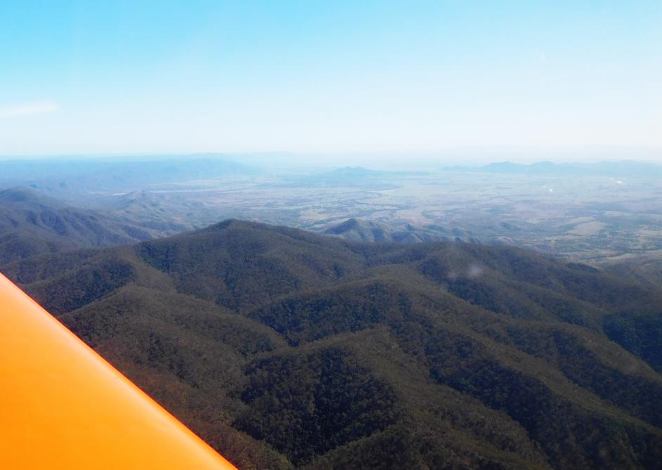
When I opened the Sonex I found a note had been stuffed into the canopy. It turned out to be from a local Sonex builder named Brent. Mine was the first Sonex he had seen in Australia. I could have done the remainder of the trip without a stop but fuel wasn’t available at Hedlow so I needed to refuel at Thangool for the trip out as well as in. I cleaned off the heavy layer of condensation, topped up the oil and completed the daily and checked in with my wife while warming the engine and then headed off into the sun, climbing to 7500 to cross the Great Dividing Range. The dividing range is not particularly great here, although it is pretty wide and the country is rugged, effectively consisting of several ranges. I was deliberately crossing a part where none of the hills were more that about 2000 feet. Towns were still very scattered and while many of the farms have airstrips, they are not necessarily marked on maps. At one stage I was doing the usual scan around for suitable open landing areas and suddenly noticed a huge grass runway immediately below.
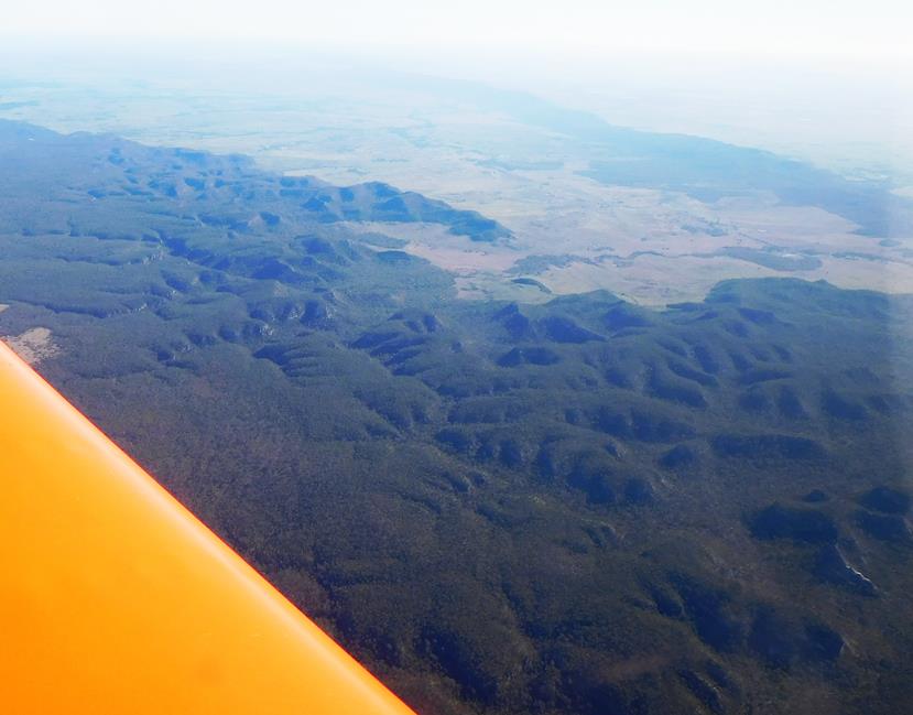
Some of the earlier parts of the range
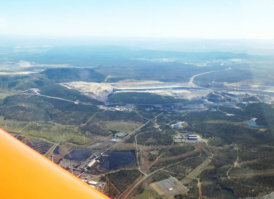
 After 117 NM comes my only waypoint, the small town of Theodore on the junction of Castle creek and the Dawson River, named after Edward (Red Ted) Theodore, premier of Queensland in the early 1920s. I drove through this area in May 2015 and remember that it was quite a pretty town and that all the outskirts were covered in cotton, presumably the local crop. Just to the north of the town, and faintly visible in the photograph is the southern end of the Moura Mine, a 47 km long open cut coal mine. It wasn’t always an open cut, and more than 40 miners have died in three separate disasters in the underground mine.
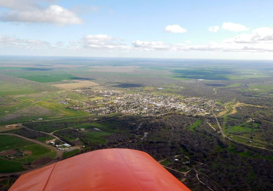
40 NM on is my final refueling stop at Thangool. It’s surprising that such a small town, population less than 900, should have a security controlled airport, but it also services Biloela, a little to the north. After refueling the Sonex I needed to use the facilities in the little passenger terminal but couldn’t find a code for the gate to get back to the airside. No problem, the fence around the side was only a little over waist high and easily vaulted. Fuel used, 29.5 litres.
Thangool to Hedlow – 85 NM
This was only an 85 NM trip but the first 50 miles was over a low mountain range with a very limited number of places where an out-landing might be possible and the next 25 miles was over the crocodile country I mentioned earlier. The wind had picked up a bit and there was plenty of turbulence as I turned onto a heading of 012° for Port Alma, my first waypoint, and climbed hard to clear the bumps and the last of the dividing range.

 Only 10 miles north of Thangool is the Callide B power station and several open cut coal mines which presumably supply it. I had crossed the first part of the range at 5500 feet but after only 30 NM had to start my descent to get under the 4500 foot layer of Rockhampton’s controlled airspace.
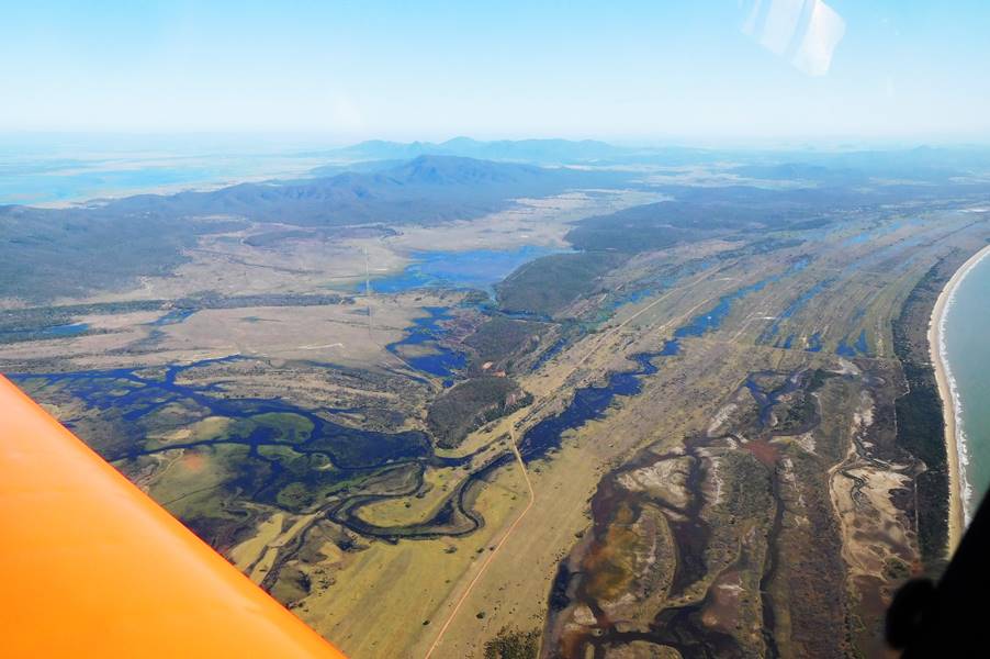
 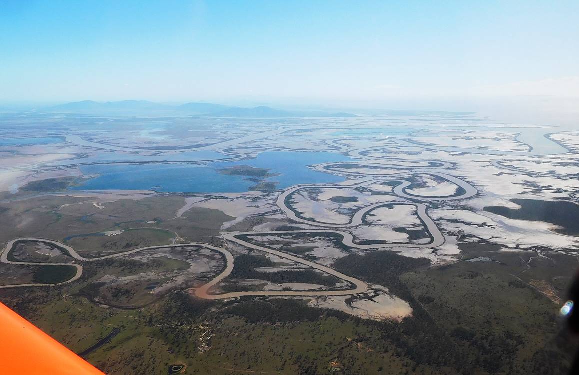 Other than controlling altitude I didn’t really need to navigate by this stage. My course was quite clear; aim for the coast across the mud. The distance from the nearest bend in the stream to the point of land in the distance is about 12 nautical miles.
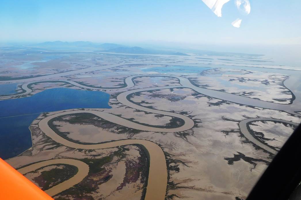 I was curious about what Port Alma was used for. At a guess you’d say that they are exporting mud, but according to Wikipedia it’s used for class 1 explosives, ammonium nitrate (is that a class 2 explosive?) bulk tallow and military equipment. A friend of mine used to work for Orica and he mentioned being at a mine when they set off 500 tons of explosive at one time. That’s a big bang and that quantity would require bulk handling.
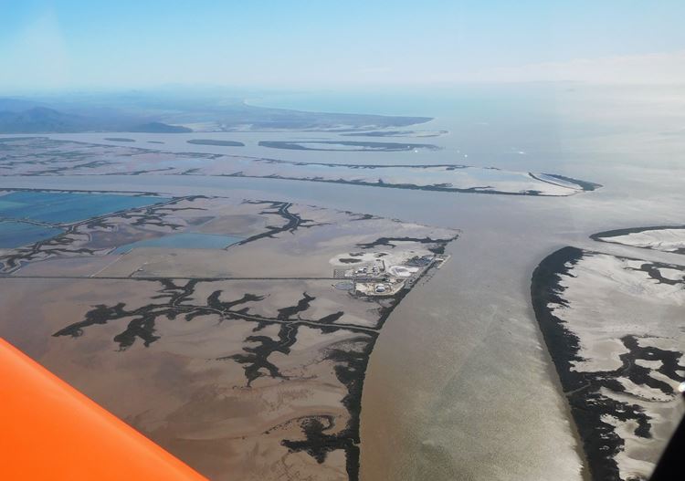
By the time I passed Port Alma I had the nose down and let the speed build up as I tracked north along the coast towards the little town of Keppel Sands where I would turn back inland and needed to be under 2500 feet.
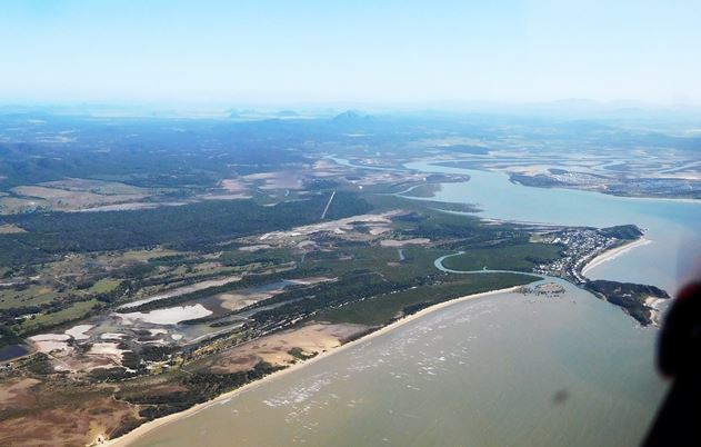
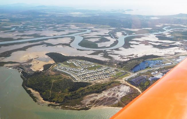 This little housing estate is just across the water from Keppel Sands which appears in the third of the above photos. I thought this looked like a pretty crazy place to build houses, but it’s actually on higher ground than Keppel Sands. If projected sea level rises occur the residents might need a boat to get home though. Once again, navigation was easy. There is a large rock, Mount Iron Pot, protruding nearly 500 feet above the plane and it’s right inside Hedlow’s circuit area. I gave my 10 mile inbound call and headed for the rock. It was pretty obvious that the landing was going to be tricky. Hedlow is only 5 miles north of Mount Archer, and with wind from the south west there was a pretty solid crosswind component and lots of mechanical turbulence. My landing was absolute crap and as I taxied in I thought “Hope nobody saw that one”, a forlorn hope. I called my wife to let her know I was alive, called my sister for a lift and topped up the tank with the 10 litres of fuel I had carried all the way from Victoria. I had used about 12 litres for this leg.
Total distance: 930 nautical miles
Fuel used: 147 litres
Flying time: 8.14 hours
If you’d like to read about the return journey go to:
Kyneton to Rockhampton Part 2 – the return